Sunday, July 25, 2010

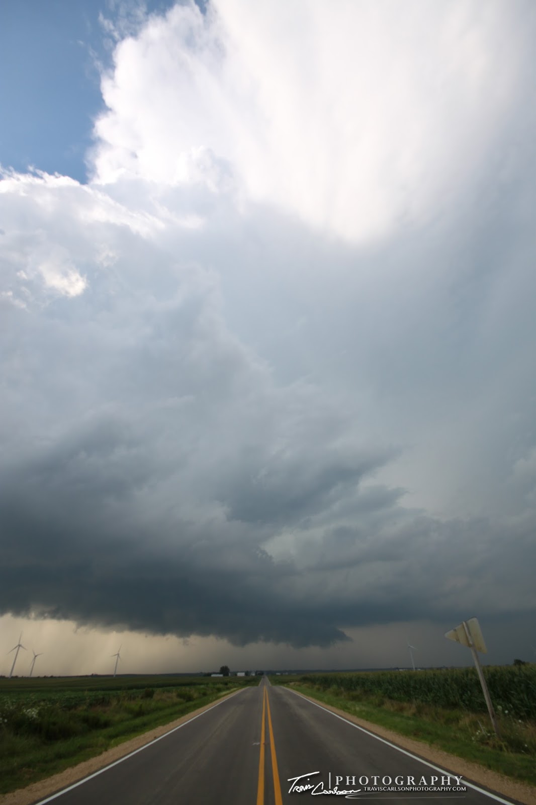
07/19/10 Ring of Fire: MCS

The "Ring of Fire" weather pattern sparks a severe
MCS
over west-central Illinois south of Kewanee, IL

Monday, a rather large and potent MCS formed across portions of northeast Missouri and west-central Illinois. This MCS formed along a remnant outflow boundary from morning convection earlier in the day. This boundary set the stage for the clash of air masses with a more "stable" boundary layer to the northeast and a very unstable air mass to the southwest across Missouri. Add a rather potent shortwave trough and severe thunderstorms quickly initiated by late-evening across west-central Illinois along the edge of the central plains heat dome. Unfortunately, I was unable to get out and chase this event. I was kicking myself for not driving an hour or two south near Pekin, IL where some chasers found a picturesque shelf cloud at sunset though. Anyhow, I ended up staying home and decided to do some sunset/lightning photography with some atomic bomb anvils in the southern horizon. My laziness actually kind of payed off with a few decent photo opportunities at sunset, but not what I was hoping for. I've added some photos from the evening and night below:

One of those "atomic bomb" anvils at dusk
Looking southeast at the anvil blow-off off from
some
nasty convection in central Illinois
The sun sets on a decaying updraft in the western horizon
A few bolts I was able to grab around 10:00pm or so

Over the last few days we've really missed out on several chances for severe weather in the local-area. This was all due to the stationary front that had been hanging around for nearly a week never lined up quite right. Convection either fired south across central Illinois or way north along the IL/WI border for the most part this past week. Both of those areas however had major flooding problems over the last few days due to the heavy rainfall over prolonged periods. Anyhow, yesterday I did manage to get off work early enough to chase some severe convection in central Illinois last evening. I'll post those photos when I get a chance. One of the best shelf clouds I've seen in years actually! Stay tuned...

Sunday, July 18, 2010

07/12/10 New Bedford, IL Supercell

Supercell (outflow dominate) west of New Bedford, IL
in northern Bureau County, IL

Monday, featured a short drive north of Kewanee, IL along the I-80 corridor near the town of New Bedford, IL. This was a quick throw all the gear into the SUV and hit the road kind of chase. I monitored mesoanalysis and reflectivity most of the day from home and saw a remnant outflow boundary that a decaying supercell in eastern Iowa was approaching. Well, at the time I had nothing better to do on my day-off so I thought yet another local chase was needed. Anyhow, I figured I'd catch up to this storm as it hit the outflow boundary and crossed into Illinois east of the Mississippi River. That's an area of far better chase-terrain! Not to mention this storm was entering a better environment as well with a pocket of instability present, 0-6km shear around 30kts, and dew points near 70°F once again. Upon arrival this thunderstorm looked not very impressive west of Hooppole, IL and honestly I didn't expect much from this chase, but strange things can and do often happen along outflow boundaries folks. As I arrived shortly after 4:00pm I quickly noticed a wall cloud huggin' the Illinois landscape as this storm organized with each reflectivity scan. Since this storm wasn't in too big of a hurry I sat here for a good half hour or so getting some time-lapse video as it began to intersect the outflow boundary. Thereafter, it quickly began to get a tad more organized. As the storm continued tracking to the east into Bureau County, IL I stopped many times along the way adding some more Illinois storm structure shots to my 2010 collection. In a few instances, this storm did exhibit some rotation with "notches" forming along the shelf where it was intersecting the outflow boundary. It never got close to producing a tornado though, but I still was able to get some decent convection out of a boring severe weather day. I've added some photos and a time-lapse below:

First view of the storm west of Hoopole ,IL with
its lowered-base/wall cloud in the distance
A shelf cloud quickly begins to form here as it crosses the outflow
boundary left-over from earlier in the day
Grungy structure at this point, but it
would get better later...

I did see some odd motion in here as this
cell got a tad more organized
Shelf cloud becomes much more pronounced...
Storm at this point has some rotation on radar...
(Definitely one of my favorite shots from the day)

Storm showing off some decent structure
Some supercell characteristics again..
notice the notch (right)
A storm highway shot here as the outflow
dominate supercell continues east
One last shot of the storm's shelf cloud as darkness
approaches near Princeton, IL...

I've added a YouTube time-lapse (above)


That concludes this chase log. It sure was nice to get out again and see some convection indeed. We should get some more chances at thunderstorms and severe weather over the next few days in the ring-of-fire pattern that sets up. In other words, very hot/humid conditions will persist with periodic MCS activity over the next week or so. After all, we are in the "Dog Days" of summer...

Wednesday, July 14, 2010

07/11/10 Bradford, IL Supercell

Supercell traversing through Bradford, IL
and a local wind farm

Sunday, I managed to get a nice reward for my patience. I spent most of Sunday afternoon monitoring the weather situation in the local-area as the previous night's model-runs showed some hidden tornadic/supercell potential in southeast Iowa and west-central Illinois. Sure enough shortly after 5:00pm a t-storm developed near Cambridge, IL. I quickly got out the door and began to hit the road to get in some late-evening storm photography. In the back of my mind I knew that their was a possibility to get some hidden surprises out of this local-chase or for that matter some picturesque photography near sunset. Why? Take a look at the marginal ingredients: CAPE (instability), 0-6km shear, and a moist boundary layer (70°F). I headed north out of Kewanee, IL on IL-Rt. 78. As I headed north a new storm initiated directly over Kewanee, IL to my south putting me out of position for the time being. This meant a core-punch folks! I punched through the core south of Neponset, IL and this was where I first got a view of a developing supercell along IL-Rt. 93 west of Bradford, IL. I then headed south (in a hurry) to a local wind farm south of Bradford, IL along IL-Rt. 93 as the storm turns right. I sat near this wind farm for a good while taking some time-lapse video and of course I photograph the structure of this supercell. I was rather happy with my reward from good ole' Mother Nature to say the least. This supercell continued east and I grabbed more structure shots as it became outflow dominate just before crossing the Illinois River where I finally let "her" go. A great chase for one of those marginal day's for myself! I've done great this year on these marginal days, but left always disappointed on the "big" days this year for some reason or another. It should be the opposite right?! Oh well, I can't complain...especially since I've had a knack of getting rewarded this year when everyone else stays home...I've added photos and a time-lapse from this local chase day below:

One of those "whoa" shots...
Supercell progressing southeast in rural-Stark County, IL
The "sups" southwest flank over the wind farm
Wall cloud/pronounced lowering under the base
She made an effort with some needle funnels...
Portrait-view of the rotating updraft
Wall cloud tries to produce here but just not enough
low-level shear for tornadogenesis folks

More structure just farther south and
east near Camp Grove, IL

Supercell becomes outflow dominate (above)
Picturesque and rewarding storm
on an otherwise "marginal" severe weather day

Awesome rain/hail foot!
Double rainbow!
Illinois vegetation and rainbow
Stellar rainbow as I stay away from the 3/4 inch hail
Towering convection at sunset with
my Canon telephoto-zoom lens
More of the same...
The sun sets on a battle-scared pine tree
from a previous severe weather event

I've added a YouTube time-lapse from the chase (above)

That's all for this chase day for the moment. I'll be adding another chase log here in the coming days from this Monday as I once again found myself chasing another marginal severe weather day here in the local-area . Stay tuned...

Monday, July 5, 2010

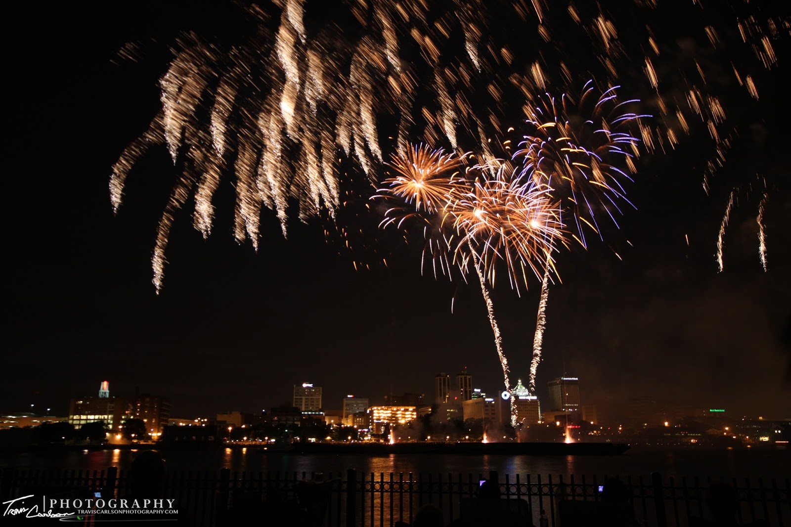
07/04/10 4th of July Fireworks: Peoria, IL

4th of July firework celebration along
the Peoria, IL riverfront

Sunday, I attended the 4th of July celebration along the Illinois River in Peoria, IL. I've always wanted to have the opportunity to photograph the 4th of July firework display in this area, but something would always come up in years past. Since however, the weather pattern in terms of severe weather has been in quite a lull as of late I figured I might as well use my free-time to photograph Peoria's firework display. Typically, I end up photographing local displays near home (Kewanee, IL, Galva, IL, etc.), but this year I decided it was time for a change. Something like $100,000 was spent on this firework display I heard earlier in the week which if you think about it equated to a little over $3,000 per minute during the 30 minute show. That's a much larger firework budget than the local shows I usually attend to say the least. The traffic/congestion near the river just before the show was insane which resembled utter chaos in some cases. I can only imagine what's like in Chicago, IL during the 4th of July after attending this more "crowded" celebration than I'm accustomed to. Other than a few "characters" in the crowd that maybe chugged a few too many it seemed most people were on their best behavior making the show more enjoyable...Anyhow, after spending some of the evening getting set up and warding off mosquitoes it was time for the show at dusk...I've added photos and some video of the best firework celebration I've seen to-date below:

Peoria, IL riverfront at dusk just before the show...
And the show begins...
We had an awesome spot for the show to say the least
Typical multi-color fireworks
One of my favorite shots from the night!
Close enough to fill up the
wide-angle lens...that's intense!
Peoria, IL skyline getting rather colorful
Amazing watching the embers fall into
the Illinois River from this "weeping willow"
A rather gold lookin' skyline
Barge (center)...couldn't ask for a better set up location
(I'll have to remember this semi-secret location for future reference)

Another one of my favorite shots from the evening
Colorful display here...this show wasn't disappointing at all
(best firework display I've seen)
Firework (UFO) hovering over downtown Peoria, IL
More and more firework fun...
Lets begin the finale'
The crowd (foreground) enjoying the last of the show
The beginning of the end (Grand finale')
Beautiful shot!
More firework mayhem as the show comes to an end
 
I've added a YouTube animation of the finale'
using my still photographs (above)


I'm one who enjoys the "challenge" shooting the annual firework celebrations during the 4th of July. It's always nice to sharpen-up on some night photography every now and then when there are no storms around to chase...