

Peaking early November fall colors at Detweiler Park in Peoria, IL
In October and early November, I ended up traveling to several parks in Peoria, IL to photograph some late-season fall foliage. Last fall, was a strange year for fall photography since fall colors peaked in early November which is much later than normal in this area. With that being said, it allowed me to find some down time in my schedule to capture some stunning late-season fall color in the local area. I visited several of my favorite parks including: Detweiler Park, Charter Oak Park, Jubilee College State Park, Matthiessen State Park, Sommer Park, and Starved Rock State Park as well. I was quite pleased with a large collection of photos I shot last October and November. I've added many of my favorites showcasing the fall colors and the fall season below:

"October pumpkins"

Amazing array of fall colors here!

"Hiking into fall"

"Reflecting on the changing season"

A spectacular morning display!

Cool fall color bokeh!

An amazing hike on this morning as the fall colors were around every corner!

"Fall landscapes"

"Pumpkin & gourd season"

"Golden tree"

Golds and reds!

"Castle on the hill"

"Fall harvest"

Fall colors starting to "pop" on this morning...

The hike on this particular morning was great for fall photography!

"Pumpkin time"

Browns and yellows!

"The winding roads during autumn"

Peaking fall color!

"Frosty"

"Fall color reaching toward the heavens"

Lots of different colors...

"Running against the wind"

"Golden"

"Frosty fall landscape"

Magnificent fall colors!

"Fall travels"

Quite a beautiful autumn morning at the lake!

Fall is such a fun season to photograph!

"Mums season"

Hiking at Starved Rock

A fountain with autumn colors in the background...

This particular morning was by far my best day of fall photography last year...

It just keeps getting better...

Spectacular gold colors!

Insane fall colors!

Colorful pumpkins!

"The streams of autumn"

More red's and gold's!

"Fall backroads"

These trees were quite photogenic!

A frosty morning provided some vibrant autumn colors!

The morning sunshine was perfect for this fall landscape!

"You never know what's around the corner"

I thought this was a unique tree amidst all the fall foliage...
You can't miss the fall foliage in every direction on this day...

A photogenic pumpkin arrangement!

Frosty mornings provide for great fall landscapes!

"America"

A favorite!

This was a really cool find...

One of the best fall reflections I've seen thus far...

"Winds of change"

Nature can be so peaceful!
Man those colors were vibrant in this reflection...

Beautiful fall mornings!

The landscape bursting with fall colors!

Love the composition with the background in this photo...

"The hills full of color"

Peaking fall color!

"A fall painting"

Mother nature is so fun to photograph!

Love this shot!

Pumpkins and gourds everywhere!

A lonesome fall tree!

The turning colors of fall...

"Autumn on fire"

"Autumn color around every corner"

Another capture of the fall season...

Fall colors on a cloudy and wet autumn morning...

One of my favorites!

Yellow foliage going crazy!

"The land of the free"

Love the insane fall colors at this lake...

The sun rises on this frosty morning...

When you find these locations where the landscape and lighting conditions cooperate you are a very happy photographer...

Sometimes a simple composition is all it takes to make a good photo...

Sweet fall colors...

"A fall run"

Another cool shot of some fall pumpkins...

A fun fall hike...

Fall begins...

Another great fall landscape!

Some vibrant yellow foliage...

Positioning the sun into this photo makes it far more unique...

It's awesome to have a park so close to home...

Fall colors have peaked!

Fall colors and a birdhouse...

Such a fun location to photograph in the fall...

More pumpkins and gourds...

This was a cool bridge along the hiking path...

Fall colors and mammatus clouds!

A brilliant yellow canopy!

Gotta love fall!

Fall colors along the Illinois River!

Fall leaves changing the landscape!

Magnificent early morning fall reflection!

Great colors!

Another beautiful fall landscape!

"Crooked tree"

"Walk on water"

Beautiful autumn path!

Photogenic pumpkin!

"The calm before the storm"

"Peace & tranquility of autumn"

Leaves are not the only colorful things to photograph in the fall...

"Watch your step"

A neat fall landscape!

"Golden"

Another awesome autumn morning!

Nature showing off all her colors...

The sun rises on a beautiful late-fall morning!

One of the many favorites from this past fall!

Fall masterpieces!

"Stairway to fall"

"Pumpkin mayhem"

Another great fall reflection!

Love the fall bokeh!

A neat shot at Jubilee College State Park

A fall perspective!

A cool fall macro-shot!
One of my favorite locations for fall photography!

"Water rising"

"The long shadows of autumn"

"Fall roads"

"Winds bringing a change in season"

"Changing colors"

Some vibrant red maples!

A yellow maple macro-shot!

Love the green's!

Beautiful!

Burning fall colors and a frosty landscape!

Epic fall foliage and long shadows!

Another amazing fall landscape!

Love these pumpkins!

"Burning red"

Fall is a great time of the year for some hiking...

"Hiking into a fall scene"

The yellow maples were going crazy on this morning!

Storm clouds approaching the lake!

"Flint corn"

A neat autumn scene!

The lake is full of fall colors!

This was another fall scene that I was quite happy to find during my hike!

"Color change"

The sun filters through the clouds providing a neat fall scene!

"Fallen leaves"

"Autumn tranquility"

"Early morning fall color"

Fall landscapes are fun to find and photograph...

Fall colors just starting to turn on this afternoon...

A cool shot with the colorful background!

Another neat composition of pumpkins and gourds...

Another fun drive at Detweiler Park

Another favorite!

"Fountain of youth"

More epic fall colors...

Gorgeous!

More great autumn colors at the lake...

Peaking red maples at Sommer Park

Amazing display of color!

"Stepping into fall"

A colorful landscape!

A cool fall close-up!

"Fallen"
 The colors beginning to change in this shot!
 Amazing fall color!
 "Frosty leaves"
 A beautiful morning!
 Autumn is such a beautiful time of the year!
 A stunning fall reflection!
 More good fall color...
 A fun fall hike..
 Starved Rock is a fun place to photograph especially in the fall...
 "Stormy skies on an autumn morning"
 The colors were not quite there yet on this day...
 More and more pumpkins...
 "Bridge to fall"
 Great lighting on this morning...
 Another neat vertical shot!

Vibrant red maples on this overcast morning...

"Changing seasons in the breeze"

I feel like this could be a watercolor painting with all the colors...

"Traveling during the fall season"

A really cool scene with the dock in the foreground...

Another awesome fall landscape!

A golden autumn morning!

A wet afternoon during this fall hike...

Fall colors filling the frame...

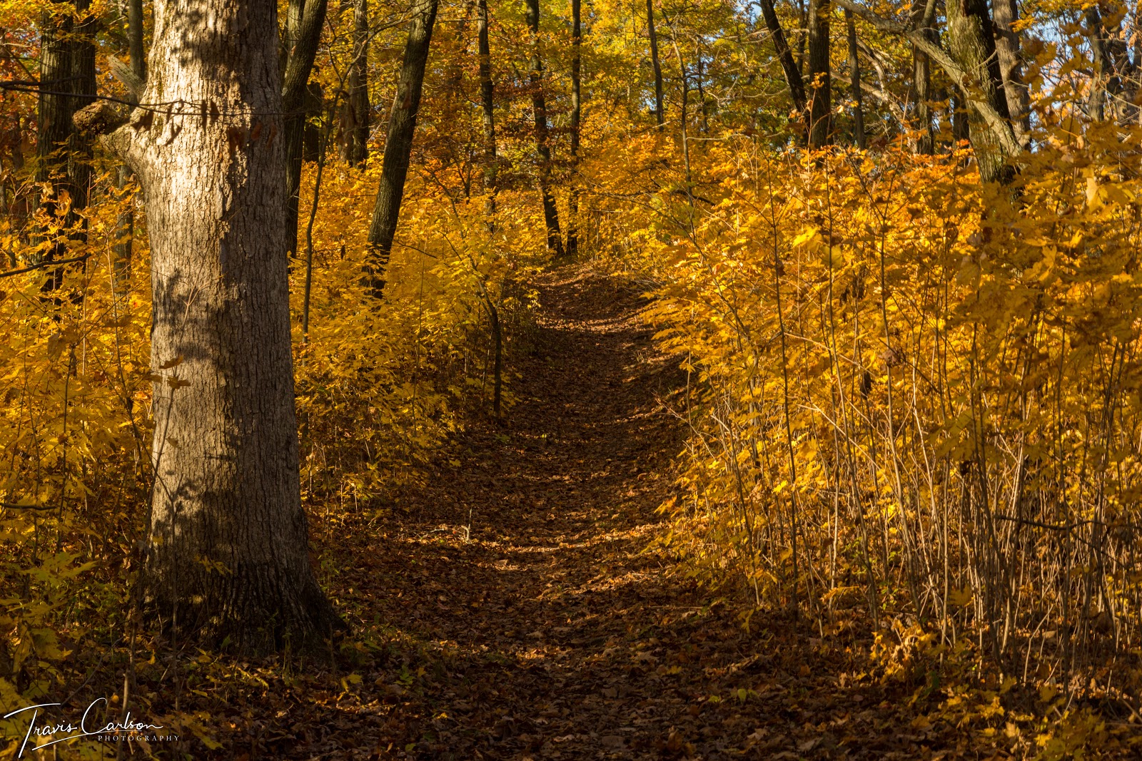
A trail at Detweiler Park

Burning orange fall colors...

"The light at the end of the path"

"Autumn streams"

Colorful fall scene!

Past peak fall colors...

"Fall landscape"

The start of a morning of fall photography...

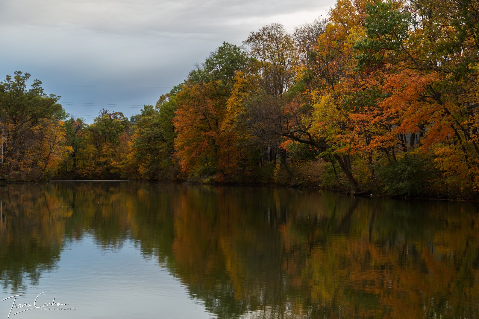
Matthiessen State Park

Another awesome macro-shot!

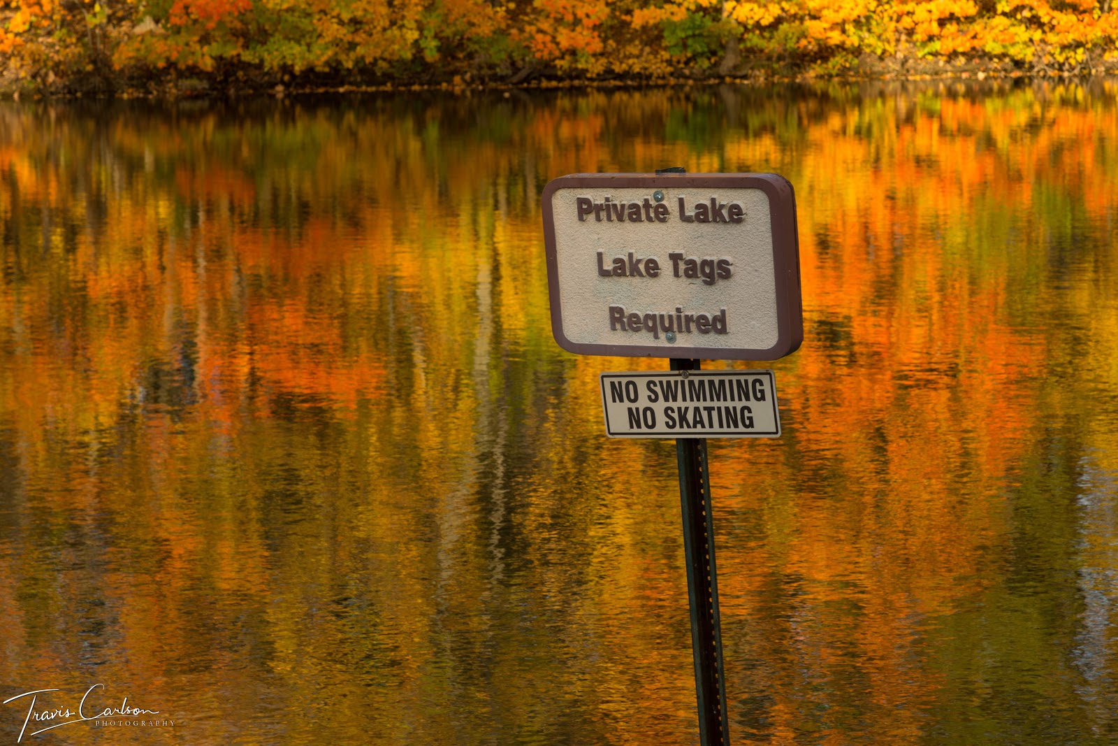
Fall reflection at Willow lake

Amazing color!

Leaves are falling everywhere...

Fall colors tend to be more vibrant the day after and during a rainstorm...

Fallen red maple leaves on a bench...

A photogenic close-up!

Magnificent yellow maples!

Wet leaves are a positive during fall photography...

Fall colors beginning to change...

Fall foliage season!

Another fall reflection at the lake!

"The colors of change"

A yellow and gold landscape!

"Destination unknown"

Fall colors along the Illinois River...

"Fall color mania"

The end of pumpkin season...

Waiting for some more autumn light...

"The woods begin to burst in color"

I would come back about a week later to an entirely different fall scene...

"The fall wilderness"

Warm gold tones of autumn...

"The change"

A spooky fall road...

A fall perspective!

Fall colors beginning to show themselves...

The end to my fall travels...
That wraps up this lengthy post to my fall collection. It was a fun few weeks of photography this past fall and I was quite pleased with many of the fall scenes I was able to capture. I'll update once again when I find some down time for some more photography over the coming months.