

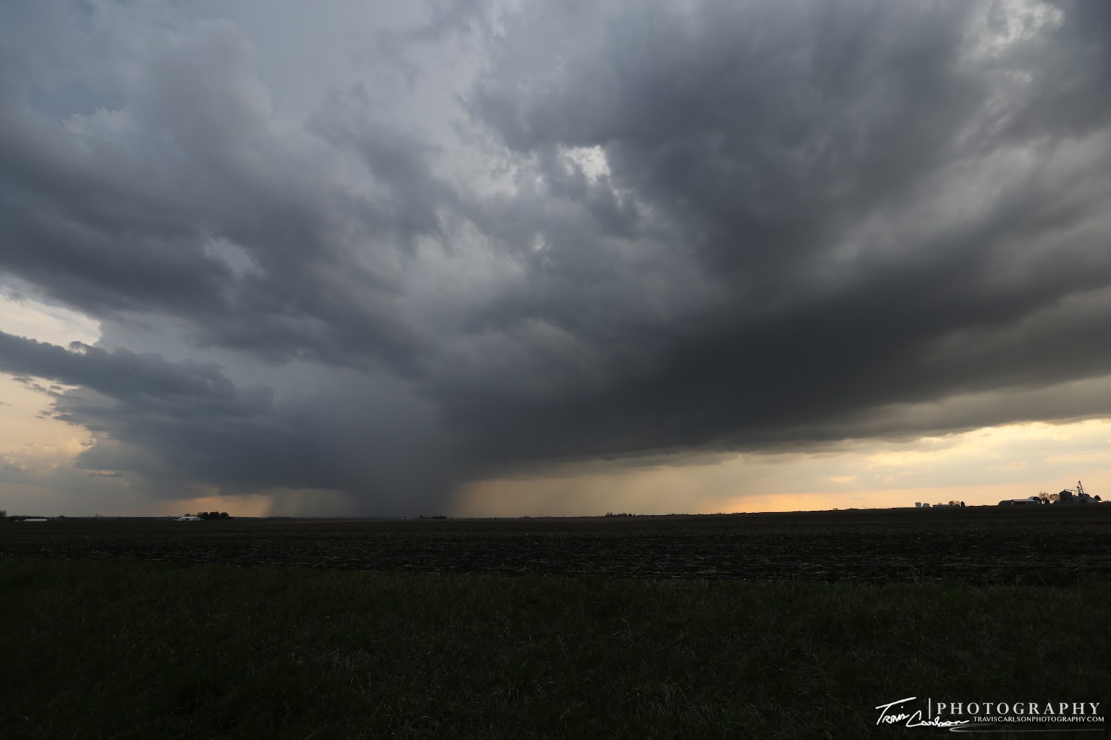
An intensifying supercell near sunset southwest of Brimfield, IL
On April 9th, I ended up chasing locally in central Illinois in the late-afternoon and evening once I left work. This was quite a spring storm system that was forecast days in advance and taking aim on Illinois. A tornado outbreak was certainly a possibility on this day. My initial target was Peoria, IL figuring that the warm front would not make it as far north into northern Illinois despite model consistency. I figured that would put central Illinois in the prime-zone for a few tornadoes. Usually, the weather models in the early spring usually do a poor job handing warm front placements due to morning convection and convective outflow impeding the boundary's movement north. It would turn out that they did a good job on this event however! Anyhow, by early afternoon I got off work as a storm went tornado-warned in Peoria County and indeed produced a tornado near Dunlap, IL. I missed that one by about 20-minutes. That storm just happened to cross the warm front that was pushing farther north. I would have liked to follow that warm front throughout the rest of the day, but I knew I had to work the following day and a trip to northern Illinois just wasn't in the cards for this particular chase day regrettably. I then targeted the cold front and in particular a pre-frontal confluence zone ahead of the existing storms in west-central Illinois as destabilization was taking place. I sat along I-74 near Brimfield, IL most of the late-afternoon along IL Rt. 78 waiting for a new storm to develop in this area. This area featured 2,000J/kg of CAPE, 0-6km shear at 50kts, the significant tornado parameter at 2, and an increasingly moist boundary-layer for early April with dew points near 64°F. I watched on radar a storm develop in this area just to my southwest and move into Peoria, IL around 5:00pm. Some weak rotation was observed with this storm, but it moved quite quickly off to the northeast and just didn't look like it was going to produce a tornado. Upon realizing this I headed back west along I-74 to intercept the other supercell along IL Rt. 78. I sat here for another hour watching this storm fizzle out initially only to explode and become quite a nice supercell. I blasted south on IL Rt. 78 to intercept this intensifying supercell. I took several shots along the highway for about 20-minutes before heading north as this supercell was catching me quite fast. This storm definitely had some decent rotation and had a cone funnel at one point becoming wrapped in rain. I'm usually quite good at not getting munched by a supercell, but this was one was an outlier as it overtook me on what seemed like "deserted" I-74 as I was trying to stay ahead of the RFD. The rain curtains were rotating and began to overtake me along the interstate at Brimfield, IL with tree limbs and debris in the air thanks to the RFD. My gut told me that there was a possible tornado nearby in the rain that was hidden. I took refuge for a few minutes at an abandoned restaurant to stay away from the dime-size hail that was falling with this supercell. Within a few minutes the hail and torrential rain stopped and the setting sun back-lit the monster updraft. Once the sun back-lit the supercell I was just able to discern another cone funnel that was wrapped in rain that became visible to my east along U.S. 150. I continued to try to catch this supercell, but once again it was moving too fast to intercept again. It ended up targeting my parent's house in Edwards, IL and my apartment in Peoria, IL. I quickly rushed to this area hoping I would not find any damage for obvious reasons. I would later learn of the devastating tornado in northern Illinois that had just took place. Some great pictures of the northern Illinois wedge tornado courtesy of Walker Ashley (professor at Northern Illinois University) can be found here. The storm I was chasing did go tornado-warned at sunset off to my northeast and I was not surprised at all given its intensity and what I observed. Peoria, IL got lucky on this day with two tornado-warned storms in the county, but no major damage reported. I shot a couple more shots at dusk as the supercell moved northeast along the sharp cold front. This was a good "test" chase day as it allowed me to get re-acclimated into the flow of chasing once again after a long winter. I've added only a few photos due to the fast storm speeds from the chase day below:

Convective initiation near 5:00pm along IL Rt. 78...

"Strongly sheared"

"Kaboom"

A pretty stout updraft northeast of Kickapoo, IL

There were a few funnel "attempts" below the updraft's base, but nothing close to a tornado...

Supercell #2 intensifying at sunset along IL Rt. 78 southwest of Brimfield, IL

Looking south toward the rotating updraft!
Quite a rain producer and about to be a hail producer as well...

Cone funnel (center-left) somewhat obscured by the rain!

Cone funnel weakens a bit here, but still present and I'm about to get munched in a few minutes...

The rain and hail ends as the supercell becomes back-lit by the sun!

A contrast-enhanced photo of the supercell and cone funnel lurking behind the hail shafts (center)

A powerful updraft at sunset!

At dusk...

A great view of the tornado-warned supercell behind the cold front!
 One more before I call it a day...
I didn't see a tornado on this chase day, but regardless it was a good start to the chase season. The pictures of the wedge in northern Illinois that many people photographed are amazing! It sure was a high-contrast photogenic tornado in that area that many storm chasers captured. We dodged a bullet here in Peoria, IL...if the warm front would have hung around here during the evening like it did during the early afternoon we could have been in real trouble...


