

Last Tuesday, one of the springs first "good" severe weather setups took shape in the Midwest. This day was a shot at redemption since Iowa has been notorious (as of late) for busts. Monday night, I had two potential targets in mind. My northern target ended up being Atlantic, IA and my south target was Creston, IA. If only I would have stayed with my original target...grr! Anyhow, a very sharp warm front was draped across most of Iowa on Tuesday. I had some prior obligations in Iowa that day to begin with, but I kept a close eye on the weather situation during the drive. I knew I could very well witness some severe convection and maybe a tornado by late-evening after reviewing model-runs and surface obs. throughout the day. This area had tornadic potential and by late-afternoon a tornado watch quickly went into effect. I played the waiting game as severe thunderstorms formed in southeast Nebraska and raced northeast into a better "environment" for supercells. The environment consisted of around 1,000J/kg CAPE, 0-6km shear around 65kts, and good low-level shear with 0-3 km SRH (Storm Relative Helicity) around 400 m2/s2. That's all you really need in early season low-CAPE setups. My thinking on the day was hold back due to the fast storm speeds and let the "environment" make my day rather than going gun-hoe and jumping on the storm. By late-afternoon I found myself farther northwest near Lyman, IA rather than my "initial target" of Creston, IA. I sat and watched one discrete cell become dominate and move into this area and I remained patient waiting for it to hit the warm front and hoping it would go crazy. Once I got my first view of the storm it looked...well...to be honest...the word starts with the letter S and ends in IT. With that being said this storm was really sucking in some air from the southeast with 30mph winds blowing into this storm picking up some decent inflow with a 76/59°F ob. Quickly, the storm started to exhibit some rotation (like someone turned-on a switch) and its base started to show an "area-of-interest" that very well could produce a weak tornado. At this time I was shooting some time-lapse video as this storm goes tornado-warned for the first time right on cue. Unfortunately, new storms started forming to its south as the cap eroded as this killed the storm as the southern storm became more dominate as it dropped a tornado near Creston, IA. After giving up on that storm and missing sporadic tornado touchdowns I ended up near Winterset, IA near sunset where another supercell developed providing some decent structure that I photographed along the dryline. This storm became tornado-warned and if it wasn't for the initial supercell contaminating the environment this one could of produced. Oh well, I may have missed the tornado at my initial target...doh...but a storm chaser is thrilled with ANY supercell structure that fills up his view-finder! This one did just that and left me happy even after missing a tornado nearby. Photos from the day I've added below as well as some time-lapse video too:

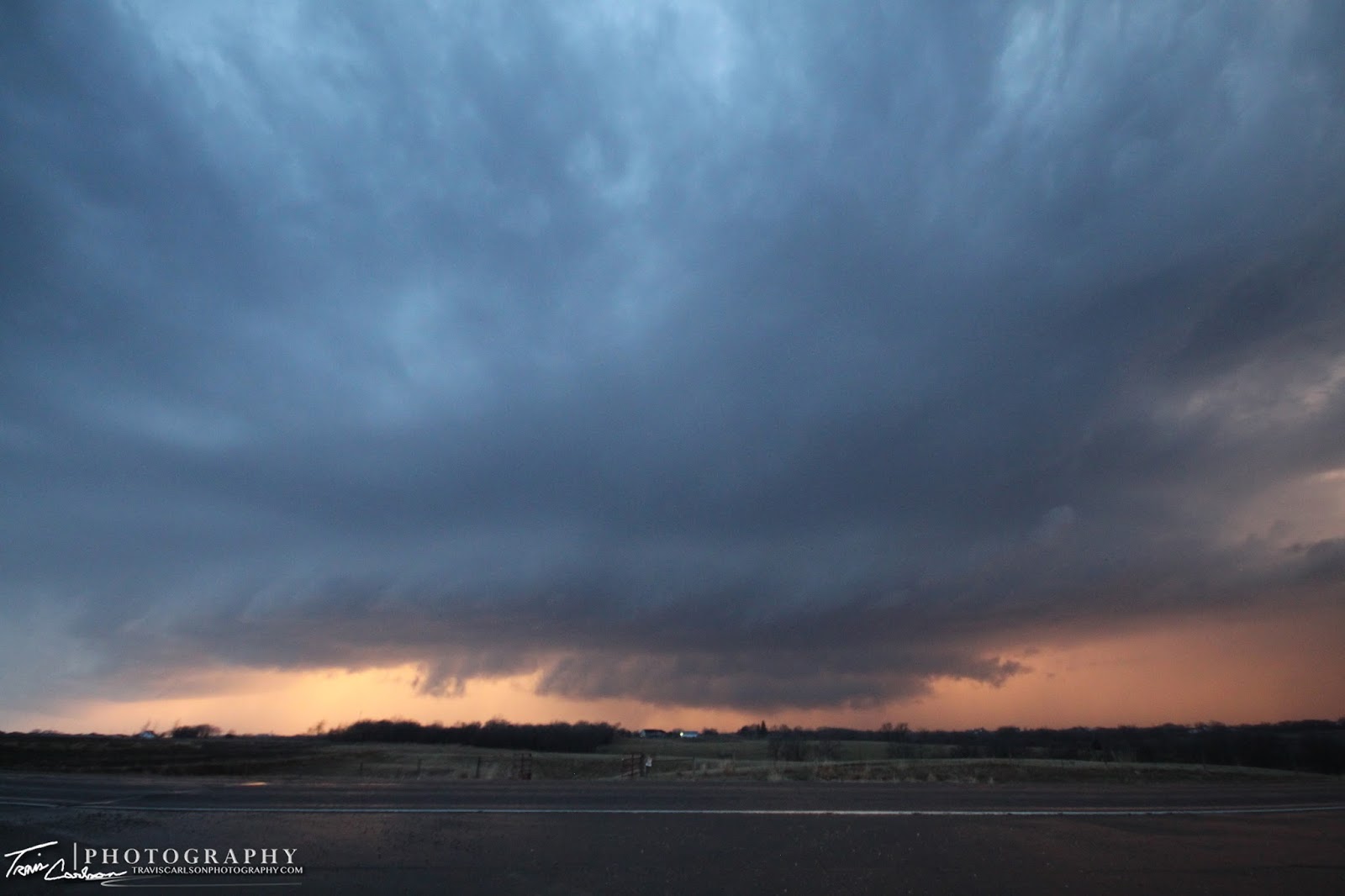
as it is about to become tornado-warned near Lyman, IA


The severe thunderstorm becomes a supercell forming
a concentrated area-of-rotation
Here's a YouTube time-lapse of the concentrated
area-of-rotation this storm exhibited (above)
 Rotation briefly weakens as I find myself
south of a hail-core here
 A...what the hail moment?
 Weird rotation exhibited here on the backside
(everything wanted to spin)

a concentrated area-of-rotation
Here's a YouTube time-lapse of the concentrated
area-of-rotation this storm exhibited (above)
south of a hail-core here
(everything wanted to spin)
Quarter-size hailstone!

The supercell's powerful updraft and hail shaft seen
here along with the March Iowa landscape
 Supercell with brief funnels now outflow dominate...

here along with the March Iowa landscape
Supercell #2 forms along the dryline
at sunset just west of Winterset, IA
Here's a YouTube time-lapse from my new addition this
chase season a GoPro camera mounted to my mobile
Davis weather station on the roof of my Ford Escape

at sunset just west of Winterset, IA
Here's a YouTube time-lapse from my new addition this
chase season a GoPro camera mounted to my mobile
Davis weather station on the roof of my Ford Escape


One of the most picturesque RFD's I've seen in awhile, but don't
let the photo fool you this sucker had a good 40mph
wind gust at least with it...

let the photo fool you this sucker had a good 40mph
wind gust at least with it...

A spectacular shot!
I didn't need to find a tornado on this day..
a photo like this will make-up for some "tornado blues"...

a photo like this will make-up for some "tornado blues"...
This supercell produces a beautiful back-lit
wall cloud (above) at sunset
Here's a YouTube video clip of the storm as the sirens sound
from my GoPro camera

wall cloud (above) at sunset
Here's a YouTube video clip of the storm as the sirens sound
from my GoPro camera
More tornado damage beneath some
beautiful mammatus...
 The house in the background lost its roof while
some storage sheds and trees were tossed in several
different directions (tornado) the NWS KDMX survey
can be found here
 One last photo showing some amazing mammatus
clouds as the storms race east toward Des Moines, IA
Here's another YouTube time-lapse using still photos
of the Winterset, IA supercell at sunset
beautiful mammatus...
some storage sheds and trees were tossed in several
different directions (tornado) the NWS KDMX survey
can be found here
clouds as the storms race east toward Des Moines, IA
Here's another YouTube time-lapse using still photos
of the Winterset, IA supercell at sunset
Overall, I can't complain since this was my best March chase I've had to-date in a few years of chasing. Usually, I don't make it even out chasing till April so seeing a supercell in March...I'll take it especially for Iowa standards! The storm reports can be found here. The synoptic pattern may allow for a few more early spring chase opportunities for myself so stay tuned...