A supercell quickly develops on this evening west of Miller, SD
On July 25th, I once again storm chased in South Dakota after visiting 1880 Town the previous day seen here. I started this chase day with a target near Winner, SD. After re-evaluating throughout the afternoon I decided to head farther northeast where a weaker cap (warm-layer aloft) resided. This area just north of the I-90 corridor northeast of Kimball, SD featured 3,000J/kg of CAPE, 0-6km shear at 50kts, a supercell composite of 8, and a moist boundary-layer with dew points near 68°F. By 6:00pm, severe thunderstorms erupted to the north in northern South Dakota near Java, SD and developed a cold pool very quickly. This created a complicated scenario for supercell development in this target area during the evening. I headed east on I-90 toward Kimball, SD seeing some cumulonimbus towers building just to the south of this developing Mesoscale Convective System (MCS) and I figured this would be where the best tornadic potential would reside. I headed north on SD Rt. 45 to intercept a developing thunderstorm that would very quickly become a supercell around 7:00pm on the southwest flank of this MCS. This supercell initially had some great structure and inflow west of Miller, SD. It nearly put down a quick tube that I photographed as well at this point. This supercell quickly got undercut by the cold pool surging from the north however. This supercell could have been quite a storm and hold some tornado potential during the late-evening if it had not been undercut by outflow. By sunset, I found myself along I-90 photographing a stunning shelf cloud near Mitchell, SD. Afterwards, I ended up driving to Sioux Falls, SD as hotels were hard to come by on this particular night and roomed at a cheap Super 8 before heading back to Illinois the next day. I've added several photos from this chase day below:

A brief venture to the NE/SD border during the early afternoon...

Heading back north into South Dakota!

A developing supercell west of Miller, SD

Closer-view...looking good!

A wide-angle shot!

"Close, but no cigar"

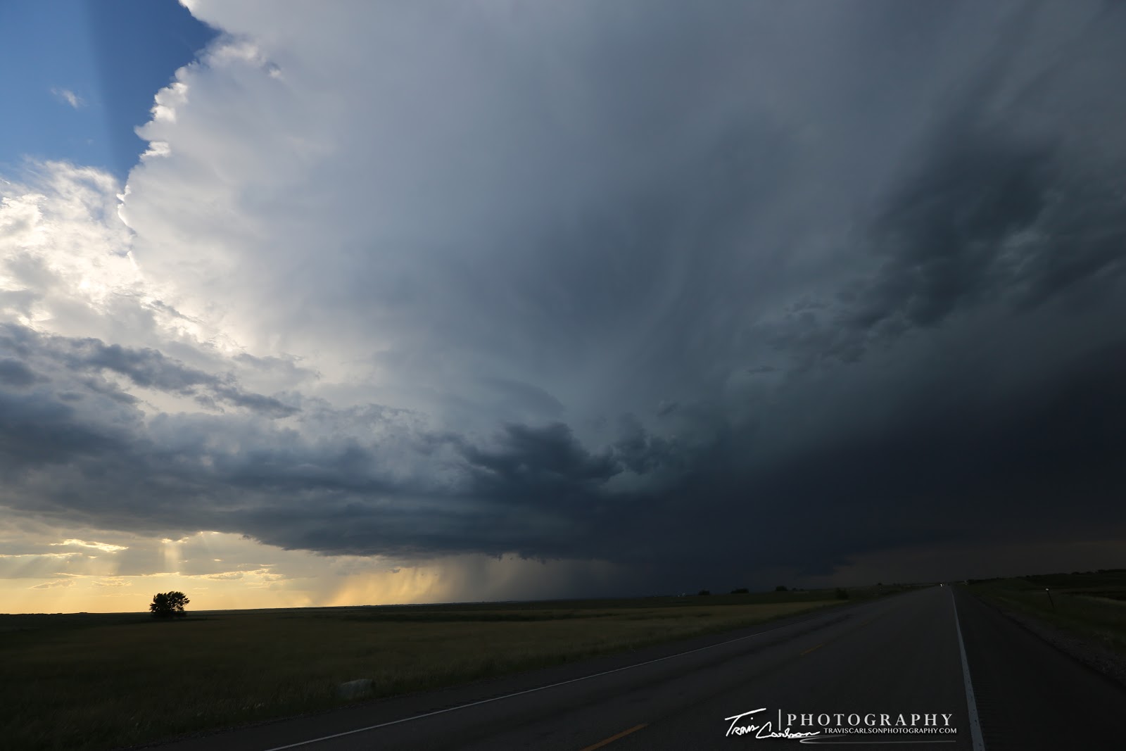
Spectacular late-evening supercell structure!

A well-defined wall cloud under the updraft's base...

Closer-view...

A South Dakota farm field as a supercell approaches!

Another close-up of the wall cloud...

I always take great pride if I have the opportunity to watch a supercell first develop...

Supercell still spinning and notice the inflow band (right)

Unfortunately, surging outflow is undercutting the rotation...

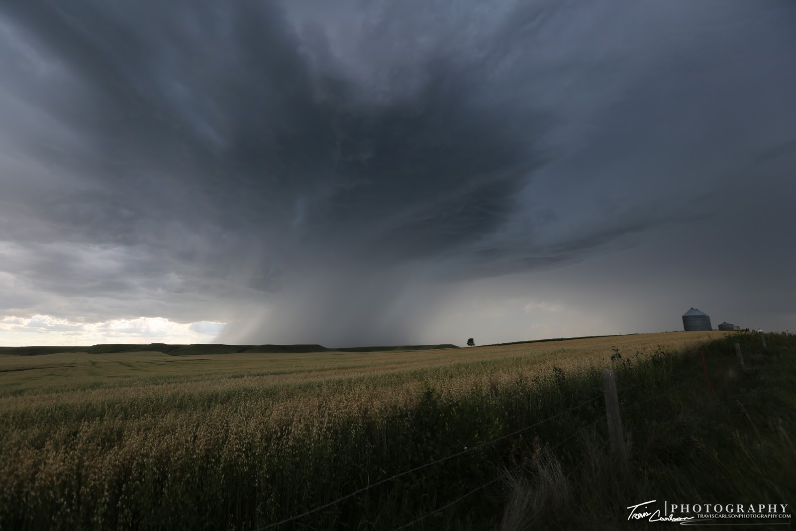
Quite a mean looking storm though...

A massive shelf cloud begins to form...

Outflow dominate at this point with a weak notch! (center)
Creepy...

I love the smell of wheat!

A photogenic display from Mother Nature!

This notch in the shelf cloud actually had some weak rotation...

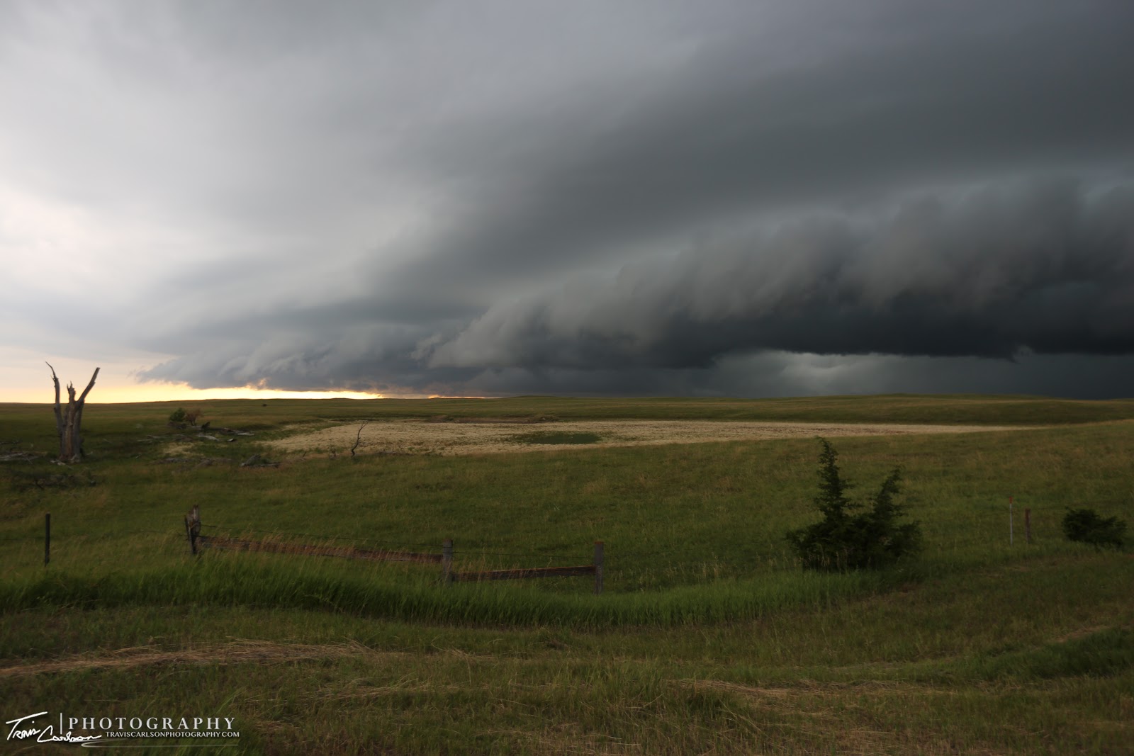
"Angry skies"

Hopefully, farm work got completed for the day...
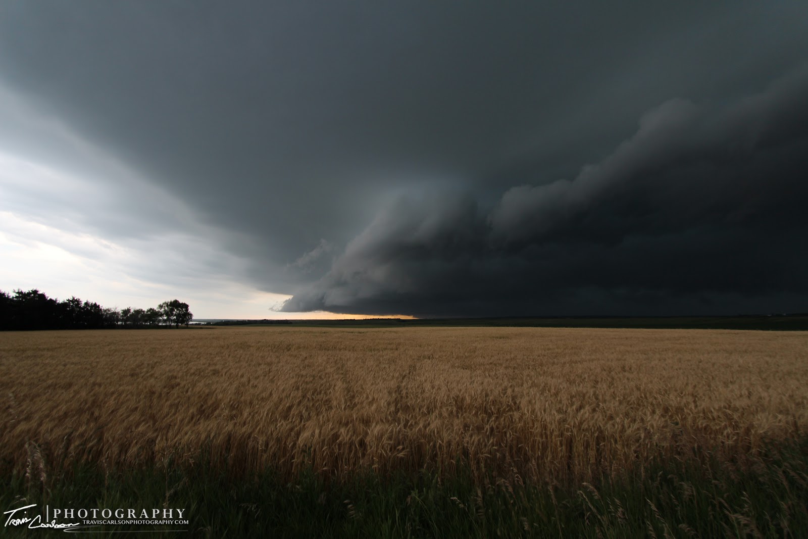
South Dakota rolling hills and a severe thunderstorm approaching...

Quite a perspective!

A pretty neat shelf cloud moving south...

I barely stayed out in front of this MCS as I was paralleling it along SD Rt. 34

One of my favorite shots from the day!

Amazing!

A wicked shelf cloud near sunset...

I found this pond along I-90 at a gas station and it provided a neat landscape as the shelf cloud approached...

What a sight west of Mitchell, SD

Even with the loss of a good amount of ambient light you can still see the shelf cloud's reflection off the pond...pretty cool!

One more shot before I'm overtaken by the shelf cloud along I-90...
This was a very successful chase day that ended my summer vacation. Tornadoes were just not in the cards on this day, but I ventured back to Peoria, IL quite pleased with some beautiful landscapes I shot during my trip and some really neat national monuments I was able to visit and photograph as well. I'll update with more photography posts in the coming weeks and months as we get closer to fall.