
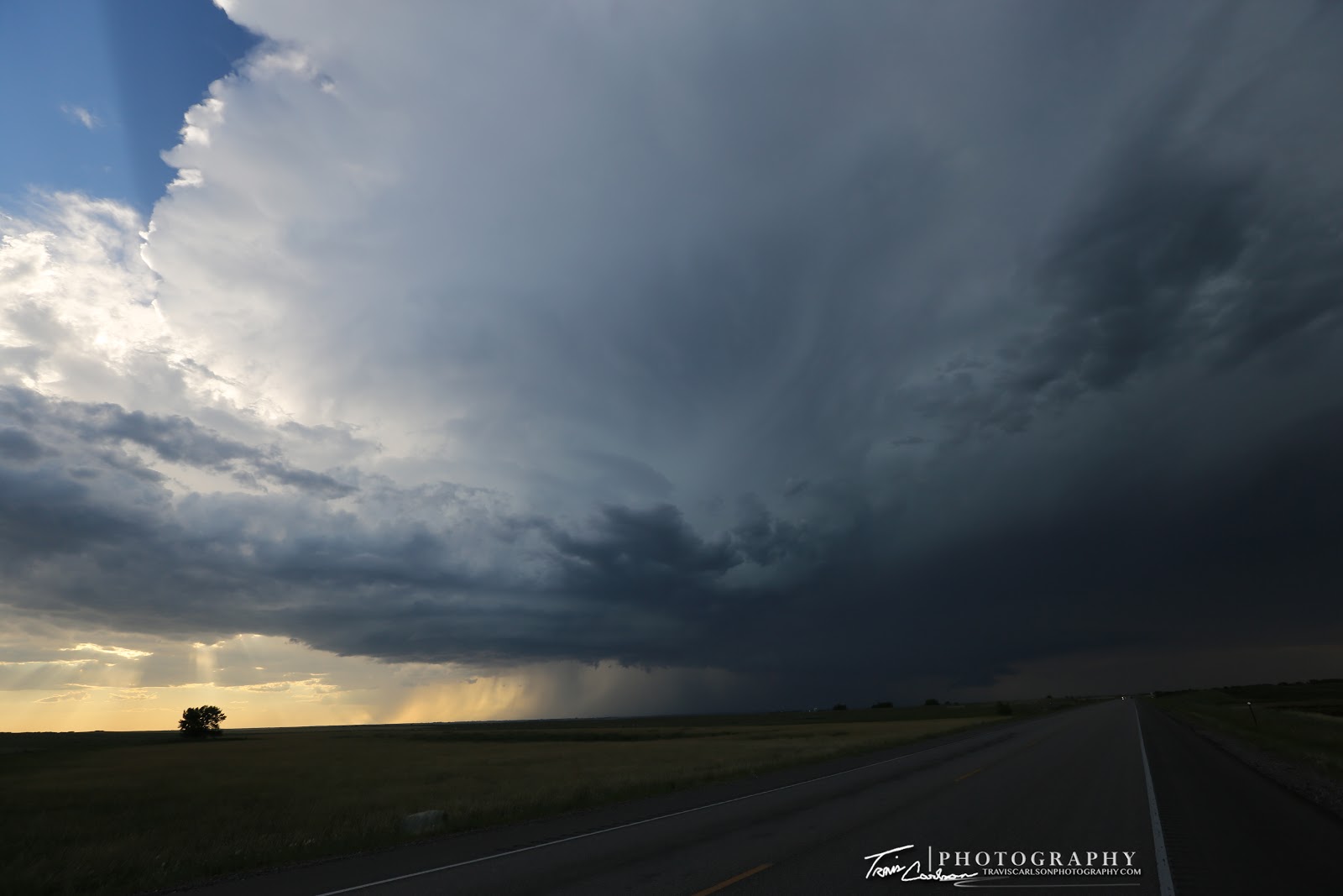
A supercell moves east on this evening toward Mound City, SD
On July 23rd, I ventured into North Dakota for some storm chasing during my summer vacation. This was my first time I've been in North Dakota and was able to cross another state off my "bucket list". I started my day at a Best Western in Wall, SD and headed north on SD Rt. 73 toward the North Dakota border. My target for the day was just south of Bismark, ND. It seemed this day would offer some good potential of catching some supercells later in the late-afternoon and evening. After eating lunch in Bismark, ND I ventured south on ND Rt. 6 as I noticed some cumulus starting to build to my southwest as a shortwave trough began to initiate convection. This area featured 5,000J/kg of CAPE, 0-6km shear strengthening over 30kts by evening, and a moist boundary-layer with dew points near 70°F. By 4:00pm, convection had already developed west of McLaughlin, SD along the ND/SD border. I watched this high-based severe thunderstorm slowly become a supercell later in the evening as increasing wind shear contributed to this storm strengthening and beginning to rotate. This supercell was at its peak intensity during the late-evening over Mound City, SD. I photographed this storm in earnest along U.S. 83 just before sunset. This was a discrete supercell, but just couldn't gain any low-level rotation to put down a tornado unlike other supercells farther southeast. I still managed to salvage some photogenic scenes across the South Dakota countryside however. I headed back south near sunset and checked into a Best Western hotel in Pierre, SD for the night. I've added some photos from the chase day below:

A brief visit into North Dakota before heading back south later in the afternoon...

High-based convection beginning to erupt to my west...

Back in South Dakota...

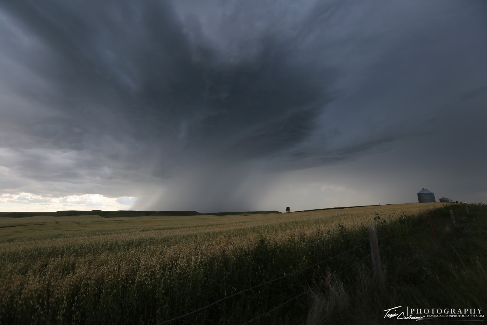
High-based supercell beginning to get organized...

I love hay bales in landscape shots!

Storm struggling to organize in a high CAPE/low-shear environment initially...
A photogenic high-based severe thunderstorm!

A random thunderstorm trying to develop all by its lonesome...

Starting to show signs of strengthening and becoming a supercell!

Finally...

An amazing storm landscape!

High-based supercell!

Another neat shot!

Getting closer to sunset...

One more shot before heading back south toward Pierre, SD
That wraps up this particular chase day. I would have much more success chasing storms on July 25th in South Dakota. I'll update with that post in the coming days.