Tuesday, June 24, 2014

06/05/14 Onawa, IA Supercell

 A supercell with a nice inflow tail moving east/southeast near Onawa, IA

On June 5th, I was on my way home to Peoria, IL traveling along I-80. I kept tabs on the weather along my route and noticed a powerful updraft north of Omaha, NE in Iowa coming into view. This storm was severe-warned and looking very interesting from a distance. After deciding this was indeed a storm to chase on my way home I jumped on I-29 and headed north for this supercell near Onawa, IA. The environment was somewhat favorable for tornadoes in this area. The area off to this supercell's southeast featured 2,000J/kg of CAPE, 0-6km shear at 40kts, and a moist boundary-layer with dew points near 65°F. As I approached this storm I pulled off the interstate just before Onawa, IA. The wall cloud was very low and even as I approached driving north on the interstate it looked like it had an "attempt". Within a few minutes however you could tell it was struggling to maintain its outflow yet still rotating. It didn't tornado, but I wish I could of got to this storm sooner and grabbed more structure shots. Oh well, I grabbed a few along the interstate and then decided it was time to go home as the storms began to weaken in this area. I've added some photos from this chase day below:

 Inflow was still really good off to the east at this point!
 Low LCL's almost got the job done!
 Shelf cloud and a wall cloud (center-right)
 Another-view...
 Closer-view as it still has a circulation! (center-right)
Whale's mouth as it starts to gust out!
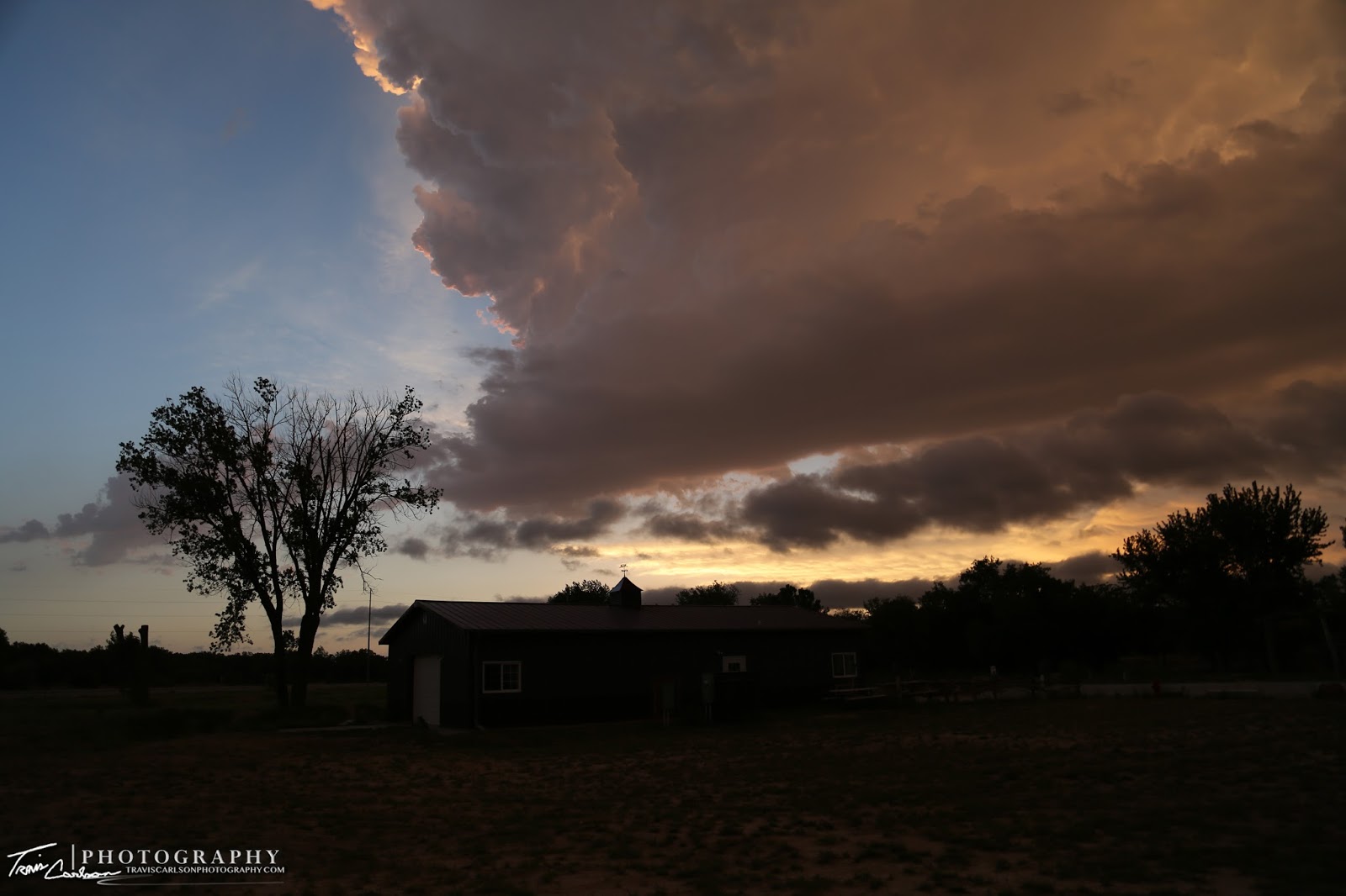
 Sunset along I-80 in Iowa...

A chase on the ride back home...can't argue with that! Iowa almost gave me a gift too! Overall, a good chase trip for photography. Tornadoes eluded me, but that will happen especially on a below-average tornado year yet again for the U.S. I'll be out chasing some more over the coming weeks so stay tuned for most posts.

Monday, June 23, 2014

06/04/14 Nebraska Convection

Convection forms on this evening near Bridgeport, NE

On June 4th, it was another upslope chase day in western Nebraska. I spent most of the day in Sidney, NE evaluating and forecasting. By mid-afternoon, convection began to develop near Scott's Bluff, NE so I decided it was time to hit the road so I headed north on U.S. 385. This area featured 3,000J/kg of CAPE, 0-6km shear at 35kts, and a moist boundary-layer with dew points near 60°F. Storms struggled however to get really organized on this chase day. One storm initiated along an outflow boundary near Bridgeport, NE that got my attention. I watched it for a good hour or so, but it really struggled to gain much rotation unfortunately. Realizing this storm wasn't gonna get it done and I didn't want to chase storms in the Sandhills to my north I ventured back to Sidney, NE. I called it a night early and roomed at a Best Western in Sidney, NE. I've added a few photos from this chase day below:

Well we got a storm to go up at least...
Another view of this storm's base...
Some interesting motion here!
Dying convection in the distance...

A tough chase day with not many storms that showed supercell characteristics in this area, but they did in Colorado unfortunately. I would decide to depart the very next morning and drive back home to Illinois, but I did find some storms along the way once again. I'll update with that post soon.

Sunday, June 22, 2014

06/03/14 Western Nebraska Supercell

 An updraft punches into the atmosphere at sunset in western Nebraska outside Gothenburg, NE

On June 3rd, it was the day that all storm chasers were waiting for during this particular week. Well at least that's what we all thought and had no reason to think otherwise. I started the day during the morning hours analyzing the potentially dangerous day at my hotel. Some of the #'s were off the charts in terms of supercell and tornado potential. In fact, it looked like it was going to be one of those days where Mother Nature shows us just how powerful she can be! Morning convection along a warm front in north-central Nebraska throughout much of the day complicated the forecast. Even with clouds thinning and daytime heating taking place by midday something just didn't feel right about this day. Models didn't have a good handle on anything because of the morning convection. I decided not to target the warm front in northern Nebraska due to the HP storm-modes and chase mob that was going to attack those storms early-on. I decided to sit in Kearney, NE most of the day hoping some of the models were correct with supercells forming along the dry line in the warm sector along I-80. It was a risky decision, but I'd rather bust then see some HP blobs for photography-purposes. A re-enforced warm front due to the morning convection kept most of the storms and supercells to my north grungy looking and an outflow boundary kept inching southwest most of the afternoon which concerned me as the "window" for surface-based storms was closing in the warm sector. I decided to blast west on I-80 by mid-afternoon heading west of North Platte, NE not seeing any signs of imminent development along I-80. The area I decided to target for a surface-based supercell in western Nebraska featured a explosive environment with nearly 5,000J/kg of CAPE, 0-6km shear at 70kts, a supercell composite of 16, a significant tornado parameter of 4, and a moist boundary-layer with dew points climbing to near 65°F. I pulled off the interstate for a half hour watching towers begin to get more and more vertical growth near Paxton, NE. I was sitting near a golf course of all places as a few "blips" began to show up on my radar to my southwest moving northeast. I got out and could tell convective initiation was indeed underway. I snapped a few photos here and there and found myself getting cored by 1.50" inch hail as I took refuge under a gas station's canopy. This supercell was beginning to get more and more organized as I jumped back east on I-80 keeping up with it near Gothenburg, NE. It had good structure for a time while I was trying to keep up, but remember that pesky outflow boundary I mentioned earlier. Well it was getting closer and closer to it. It could do a couple of things allowing this to be the storm of the day or absolutely kill it. It ended up killing it undercutting the updraft unfortunately. Damn! This would of been the big tornado producer I think if that outflow boundary would of stayed away from it. Anyhow, I decided to shoot some more shots at sunset as more convection began to develop north of Gothenburg, NE at my hotel. This made the day worthwhile with some beautiful mammatus off a developing storm's updraft. These photos ended up being shot just off I-80 at my hotel which I roomed once again at the Comfort Suites in Gothenburg, NE. It was quite a beautiful display that didn't leave me empty-handed on a disappointing day for all of us chasers as it didn't turn out like we all wanted it too. I've added photos from the chase day below:

High-based convection beginning to organize...
The beginning of the Gothenburg, NE supercell!
Crepuscular rays outside my hotel!
I get settled into my hotel only to observe this out my window...
I literally ran with my camera's out the door as fast as I could!
Wowser's!
I'm in frantic mode now trying to find something for the foreground!
I love this shot!
They don't call it "Golden Hour"  for nothing!
One of my favorite wide-angle shots!
Starting to lose the amazing late-evening sun-angle...
Convection at sunset!

Another great photography day even though I really thought this would be the day I'd catch a tornado in the Great Plains. It just wasn't in the cards though. I chased once again the following day on June 4th. Stay tuned for that post.

Saturday, June 21, 2014

06/02/14 Chimney Rock & Scott's Bluff National Monument

 Chimney Rock on a June morning outside Scott's Bluff, NE 

On June 2nd, I decided to do some sight-seeing since the risk for severe storms in the Great Plains was rather bleak. I decided to spend this down day in western Nebraska checking out Chimney Rock and Scott's Bluff National Monument along the Oregon Trail. I did some hiking and photographing along the way enjoying the tranquil weather. The next day was supposed to feature a severe weather outbreak so by mid-afternoon I called it a day and headed back east on I-80 to position myself in a favorable area for the next chase day. I roomed in Gothenburg, NE at a Comfort Suites to get rested up. I've added a few photos I snapped on this down day in western Nebraska below: 

 Chimney Rock under deep-blue skies!
 Entrance...
 Hitching a ride on the Oregon Trail!
Nebraska prairie and Chimney Rock!
A classic wagon and Scott's Bluff again...
 Scott's Bluff reminds of the Badlands of South Dakota...
 Dome Rock!
 Closer-view of Dome Rock...
 A old-fashioned wind mill and Chimney Rock!
 One more shot of Chimney Rock...

I quickly called it a day and tried to get a good night's rest as another chase day was in store on June 3rd. I'll update with that post soon.

Friday, June 20, 2014

06/01/14 NW Kansas & SW Nebraska Supercells

A dissipating supercell at sunset providing an amazing reflection outside Imperial, NE

On June 1st, I ventured out to chase yet again. Early on, I headed to Ogallala, NE and spent most of the early afternoon looking at data. The models didn't have a good handle on things most of the day because of ongoing convection along a warm front. This took the best potential for supercells along an outflow boundary that raced into Kansas. Skies cleared around noon and I decided I would have to drop into Kansas or risk seeing nothing of consequence in Nebraska. By early afternoon, the cap had already eroded in western Kansas and eastern Colorado. This area featured 2,000J/kg of CAPE, 0-6km shear at 40kts, and a moist boundary-layer with dew points near 60°F. I ventured south realizing I should have jumped the gun and headed south far sooner since I was already missing out on some supercells. I headed south on NE Rt. 61 where it intersected U.S. 36 in northern Kansas. I could tell I needed to keep going south as some bubbling towers were building near Goodland, KS. I continued south sitting just outside of town along KS Rt. 27 snapping some photos of a "left-split" that provided some picturesque mammatus. After that storm lost its vigor I found a new high-based supercell initiating west of Goodland, KS near Burlington, CO. I sat once again and after photographing this storm for about a hour it to dissolved. Frustrated with the day up to this point I noticed a supercell in far western Nebraska pushing southeast. I could just make out a rock-hard tower to my northwest and decided well I've got nothing to lose at this point and drove back north into Nebraska on NE Rt. 61. I would end up catching this supercell outside Imperial, NE just about a hour and half before sunset. It provided me with a couple hours of spectacular photogenic skies which I was quite pleased with after a frustrating chase day being out of position most of the day. Mother Nature made it up to me though with an excellent showcase at sunset! Once the sun set I checked into a Best Western in Ogallala, NE and roomed there for the night. I've added photos from this chase day below:

A "left-split" near Goodland, KS
Some very nice mammatus hovering over the Kansas landscape!
Another shot!
High-based supercell tracking along I-70...
The base quickly dissolves unfortunately on this storm as well!
Supercell near Imperial, NE near sunset!
A double rainbow as the supercell begins to dissipate with the setting sun casting my "picture-taking" silhouette!
"If you wanna see the rainbow, you got sit through a little rain"
"Between the raindrops"
A breath-taking sky!
A fence and mammatus!
"The road I'm on"
Another amazing view!
Closer view of the mammatus clouds overhead...
A lot going on here...rainbow, mammatus, and a reflection!
"A photographer's paradise"
Some of the coolest mammatus clouds from a storm's anvil I've seen to-date!
Another epic shot!
It was tricky to set up shots with the changing light at sunset, but I sure snapped some pleasing shots!
Another favorite! "Looking back at a departing storm"
"A storm's mirror image"
"A storm's reflection"
My last one at sunset!

It was quite an evening of photography and you really had to take in the dramatic skies while snapping photo after photo since the sky was simply beautiful! June 2nd was a down day with no storms in the forecast so I decided to do some sight-seeing in western Nebraska. I'll post some photos from my down day at a later date.