

An updraft punches into the atmosphere at sunset in western Nebraska outside Gothenburg, NE
On June 3rd, it was the day that all storm chasers were waiting for during this particular week. Well at least that's what we all thought and had no reason to think otherwise. I started the day during the morning hours analyzing the potentially dangerous day at my hotel. Some of the #'s were off the charts in terms of supercell and tornado potential. In fact, it looked like it was going to be one of those days where Mother Nature shows us just how powerful she can be! Morning convection along a warm front in north-central Nebraska throughout much of the day complicated the forecast. Even with clouds thinning and daytime heating taking place by midday something just didn't feel right about this day. Models didn't have a good handle on anything because of the morning convection. I decided not to target the warm front in northern Nebraska due to the HP storm-modes and chase mob that was going to attack those storms early-on. I decided to sit in Kearney, NE most of the day hoping some of the models were correct with supercells forming along the dry line in the warm sector along I-80. It was a risky decision, but I'd rather bust then see some HP blobs for photography-purposes. A re-enforced warm front due to the morning convection kept most of the storms and supercells to my north grungy looking and an outflow boundary kept inching southwest most of the afternoon which concerned me as the "window" for surface-based storms was closing in the warm sector. I decided to blast west on I-80 by mid-afternoon heading west of North Platte, NE not seeing any signs of imminent development along I-80. The area I decided to target for a surface-based supercell in western Nebraska featured a explosive environment with nearly 5,000J/kg of CAPE, 0-6km shear at 70kts, a supercell composite of 16, a significant tornado parameter of 4, and a moist boundary-layer with dew points climbing to near 65°F. I pulled off the interstate for a half hour watching towers begin to get more and more vertical growth near Paxton, NE. I was sitting near a golf course of all places as a few "blips" began to show up on my radar to my southwest moving northeast. I got out and could tell convective initiation was indeed underway. I snapped a few photos here and there and found myself getting cored by 1.50" inch hail as I took refuge under a gas station's canopy. This supercell was beginning to get more and more organized as I jumped back east on I-80 keeping up with it near Gothenburg, NE. It had good structure for a time while I was trying to keep up, but remember that pesky outflow boundary I mentioned earlier. Well it was getting closer and closer to it. It could do a couple of things allowing this to be the storm of the day or absolutely kill it. It ended up killing it undercutting the updraft unfortunately. Damn! This would of been the big tornado producer I think if that outflow boundary would of stayed away from it. Anyhow, I decided to shoot some more shots at sunset as more convection began to develop north of Gothenburg, NE at my hotel. This made the day worthwhile with some beautiful mammatus off a developing storm's updraft. These photos ended up being shot just off I-80 at my hotel which I roomed once again at the Comfort Suites in Gothenburg, NE. It was quite a beautiful display that didn't leave me empty-handed on a disappointing day for all of us chasers as it didn't turn out like we all wanted it too. I've added photos from the chase day below:

High-based convection beginning to organize...

The beginning of the Gothenburg, NE supercell!

Crepuscular rays outside my hotel!

I get settled into my hotel only to observe this out my window...
I literally ran with my camera's out the door as fast as I could!

Wowser's!

I'm in frantic mode now trying to find something for the foreground!

I love this shot!

They don't call it "Golden Hour" for nothing!

One of my favorite wide-angle shots!
Starting to lose the amazing late-evening sun-angle...

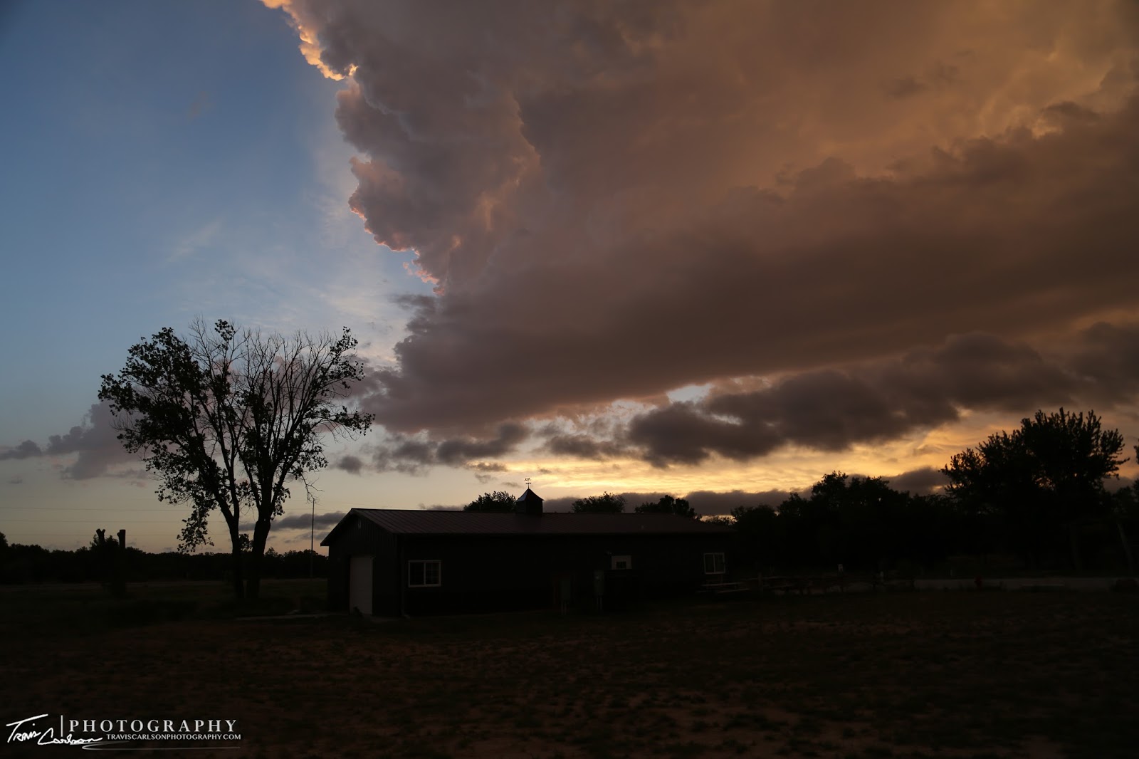
Convection at sunset!
Another great photography day even though I really thought this would be the day I'd catch a tornado in the Great Plains. It just wasn't in the cards though. I chased once again the following day on June 4th. Stay tuned for that post.