Thursday, March 31, 2011

03/22/11 Iowa Redemption?! Sort of...

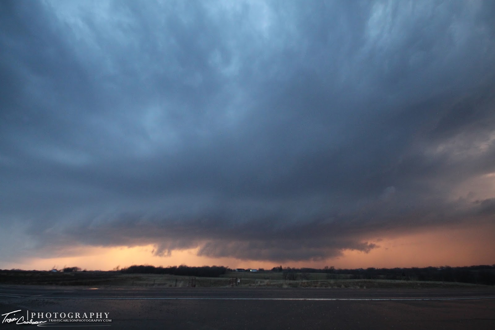
A picturesque supercell at sunset in Winterset, IA
as tornado-sirens sound in the area...

Last Tuesday, one of the springs first "good" severe weather setups took shape in the Midwest. This day was a shot at redemption since Iowa has been notorious (as of late) for busts. Monday night, I had two potential targets in mind. My northern target ended up being Atlantic, IA and my south target was Creston, IA. If only I would have stayed with my original target...grr! Anyhow, a very sharp warm front was draped across most of Iowa on Tuesday. I had some prior obligations in Iowa that day to begin with, but I kept a close eye on the weather situation during the drive. I knew I could very well witness some severe convection and maybe a tornado by late-evening after reviewing model-runs and surface obs. throughout the day. This area had tornadic potential and by late-afternoon a tornado watch quickly went into effect. I played the waiting game as severe thunderstorms formed in southeast Nebraska and raced northeast into a better "environment" for supercells. The environment consisted of around 1,000J/kg CAPE, 0-6km shear around 65kts, and good low-level shear with 0-3 km SRH (Storm Relative Helicity) around 400 m2/s2. That's all you really need in early season low-CAPE setups. My thinking on the day was hold back due to the fast storm speeds and let the "environment" make my day rather than going gun-hoe and jumping on the storm. By late-afternoon I found myself farther northwest near Lyman, IA rather than my "initial target" of Creston, IA. I sat and watched one discrete cell become dominate and move into this area and I remained patient waiting for it to hit the warm front and hoping it would go crazy. Once I got my first view of the storm it looked...well...to be honest...the word starts with the letter S and ends in IT. With that being said this storm was really sucking in some air from the southeast with 30mph winds blowing into this storm picking up some decent inflow with a 76/59°F ob. Quickly, the storm started to exhibit some rotation (like someone turned-on a switch) and its base started to show an "area-of-interest" that very well could produce a weak tornado. At this time I was shooting some time-lapse video as this storm goes tornado-warned for the first time right on cue. Unfortunately, new storms started forming to its south as the cap eroded as this killed the storm as the southern storm became more dominate as it dropped a tornado near Creston, IA. After giving up on that storm and missing sporadic tornado touchdowns I ended up near Winterset, IA near sunset where another supercell developed providing some decent structure that I photographed along the dryline. This storm became tornado-warned and if it wasn't for the initial supercell contaminating the environment this one could of produced. Oh well, I may have missed the tornado at my initial target...doh...but a storm chaser is thrilled with ANY supercell structure that fills up his view-finder! This one did just that and left me happy even after missing a tornado nearby. Photos from the day I've added below as well as some time-lapse video too:

First view of the severe thunderstorm in southwest Iowa
as it is about
to become tornado-warned near Lyman, IA
Oh, how I've missed you...convection!
The severe thunderstorm becomes a supercell forming
a concentrated area-of-rotation

Here's a YouTube time-lapse of the concentrated
area-of-rotation this storm exhibited (above)

Rotation briefly weakens as I find myself
south of a hail-core here

A...what the hail moment?
Weird rotation exhibited here on the backside
(everything wanted to spin)
Quarter-size hailstone!
The supercell's powerful updraft and hail shaft seen
here along with the March Iowa landscape
Supercell with brief funnels now outflow dominate...
Supercell #2 forms along the dryline
at sunset just west of Winterset, IA

Here's a YouTube time-lapse from my new addition this
chase season a GoPro camera mounted to my mobile
Davis weather station on the roof of my Ford Escape

Eerie lookin' sky looking south out of Winterset, IA
The Creston, IA textbook supercell from a distance
(no wonder it produced a tornado)
One of the most picturesque RFD's I've seen in awhile, but don't
let the photo fool you this sucker had a good 40mph
wind gust at least with it...
Weird area-of-rotation as the sirens get sounded in Winterset, IA
A spectacular shot!
I didn't need to find a tornado on this day..
a photo like this will
make-up for some "tornado blues"...
This supercell produces a beautiful back-lit
wall cloud (above) at sunset

Here's a YouTube video clip of the storm as the sirens sound
from my GoPro camera

More tornado damage beneath some
beautiful mammatus...

The house in the background lost its roof while
some storage
sheds and trees were tossed in several
different directions (tornado) the NWS KDMX survey
can be found here

One last photo showing some amazing mammatus
clouds as the storms race east toward Des Moines, IA
 
Here's another YouTube time-lapse using still photos
of the Winterset, IA supercell at sunset

Overall, I can't complain since this was my best March chase I've had to-date in a few years of chasing. Usually, I don't make it even out chasing till April so seeing a supercell in March...I'll take it especially for Iowa standards! The storm reports can be found here. The synoptic pattern may allow for a few more early spring chase opportunities for myself so stay tuned...

Sunday, February 13, 2011

02/01/11 Blizzard 2011: Snowmageddon

Rural-Stark County, IL outside Kewanee, IL picked up
around 17" inches of snow during the blizzard on Feb. 1-2, 2011...


A little over a week ago, a massive winter storm/blizzard took aim on central and northern Illinois. This one was epic and indeed one for the record books. A once-in-a-10-year kind of winter storm! The last storm of this intensity that at least I can remember in this area was in 1999 when most of central Illinois received over a foot of snow. This storm (February 1-2, 2011) produced over 12" inches of snow across much of the area (17.6" Kewanee, IL) (15" Peoria, IL). Add thunder snow and 50mph winds and much of the area was crippled which left utter chaos in its wake. Many roads were left impassible and snow drifts neared 5 ft. in some areas. Talk about an Old Man Winter stranglehold! Click here to access a full write-up of the event via the NWS (ILX). Also, check out this animation/time-lapse via NASA of the massive winter storm seen from space here! I didn't get any "post worthy" photos during the event to my dismay. Frankly, it was nearly impossible with heavy snow and 50mph winds blastin' you in the face. I did manage to get some photos after the storm however from my hometown of Kewanee, IL and around Peoria, IL. This simply was an amazing storm! Bad weather seems to follow me wherever I tend to go to my liking ;)...I moved here in the fall and thanks to the blizzard we've set a record for the second snowiest winter here in Peoria, IL. Enough about the winter though because right now I'm looking forward to a very active spring severe weather season that will be here before you know it. Photos from the blizzard can be found below:

Snow drifts even burying John Deere
tractors...are you kiddin' me?

A rather nice winter scene (after the storm)...
Scenes like this really makes you want to enjoy that
moment in time with someone whether it's watching a tornado
majestically dance along the ground, a supercell traversing
in an open field, a stellar sunset, or like above a simple winter scene...

A snowy landscape outside Bradford, IL
at this local wind farm

Rural-roads had to be impassible during the storm
after seeing the depth of this snowbank (above)

A lil' bit of hoar frost I came across here
which is great for winter photography

Sunrise in Peoria, IL on the fresh
and undisturbed snow-pack here

Another shot of the wind farm gettin' plowed out interesting enough...
(This photo was taken on a sub-zero morning (-15°F) brr...)

More hoar frost under a deep blue sky...
One of my favorite shots!
You rarely get a winter storm that buries road signs...well
this was one that you could find signs nearly buried

everywhere thanks to the enormous snow piles

My family's house back home with a massive snow
drift 3 ft. deep on our outdoor deck (above)

Another awesome photo (after the storm) illustrating a fairly
big snow removal problem...frankly, where do you put

17" inches of snow seriously?!

I bet this road was fun driving on during the
peak of the storm don't you think?!

I'm a science nerd...wait a sec...I really said that?
Anyhow, on a sub-zero morning after the storm I tossed some

boiling water into the air (not my first rodeo when
it comes to this stuff)
the result can be seen (above) and (below)
Look closely and the sun behind me is creating a ghostly silhouette
to my right...pretty cool to say the least

This process is a liquid-to-gas phase change and
a form of vaporization...in this case it's evaporation since the change

is occurring below the boiling point...
oh, and yes I was freezing my a** off!
Picturesque winter scene at this farm near my hometown
Another hoar frost photo here...
A dead end...that's what a lot of drivers found about two weeks ago
This statue was nearly buried by a snowdrift
I've never seen this...and I've documented many winter storms
in this area...the snow drifts went yes...over the fence in our pasture

...that's about 4-5 ft. high...simply amazing!

A winter photo here where I graduated high school in 2004
which
feels like an eternity ago...damn I'm freakin' old...
The apartment complex where I live here in
Peoria, IL after the storm

Our outdoor pool enclosure...can't wait to do some stargazing
this summer here (kind of like having your very

own observatory in a way)...

Apartments at Grand Prairie in Peoria, IL
(This guy couldn't make it out of the parking lot too far)...


Well, finally I ended up getting around to some winter photography. The main reason I haven't been able to do much photography this winter is work truthfully, but working hard now is important. Why? Well, I'll have all the time in the world come May-June...at least we can all dream can't we? A vacation sure sounds good right about now though...

Thursday, January 6, 2011

01/05/11 Christmas: 2010

Home for the holidays in Kewanee, IL

It's been quite awhile since I've found some down time for some photography I'd say. How bout a few months to be exact, but that's what a full-time job and moving away from your hometown will do though. You'll quickly find it's much harder to find free time, but that's indeed what happens when your priorities change in a big way. Currently, I'm living at the Apartments at Grand Prairie in Peoria, IL. I just might be the only weather nerd in the area to have a Davis weather station on the deck of their apartment. If you're wondering you can find my streaming weather obs. on the northwest-side of Peoria, IL here. As far as the winter goes we've had quite a few winter storms to say the least in this area already. I can't wait for spring though and it's only January...ugh! Sorry folks, supercells and tornadoes that you don't necessarily like is exactly what a storm chaser loves with a passion. Anyhow, over the holidays I had the opportunity to do some photography-work and photograph my parents holiday light display in my hometown of Kewanee, IL. I've included a handful of my photos below:

One of our recent additions to our property...our above-ground
pool now enclosed and now a nice skating rink

thanks to good ole' old man winter

I used to live here...2010 was a year of change...2011
I'm thinkin' is a year of new beginnings...

Great example of why you need a DSLR camera in low-light
situations...i don't think I've touched my
point-n-shoot camera in years

Our holiday Christmas lights lighting up this path...
Talk bout' a block of ice in our pool..
you just have to enjoy those Midwest winters huh?

Entrance to the house decorated for the Christmas season
Wide-angle shot of our above-ground pool all "lit-up"
The front of the house!
Simply amazing the reflection off the pool...
kind of makes you wonder if this is Mr. Freeze's lair?

Another shot of the front walkway to our house
Another wide-angle shot...
Another view of the enclosed-pool...
What is Christmas without a Christmas tree right?
Pretty cool tree that pulsates different colors
One last shot of the house from the front yard
An outdoor bench with a Christmas feel...

That's all for now...I've snapped a few photos from this winter already, but instead of posting them every week or so I'm gonna do something different this year. I'm planning on posting a winter collection in the next few months of some of my better photos from this winter. Until then enjoy the new year and some bone-chilling arctic air on the way!