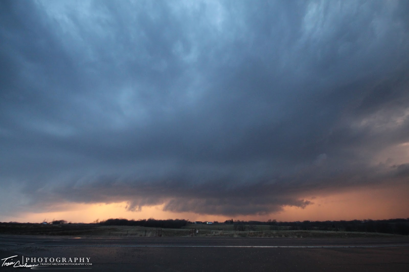
A mini-supercell develops along a pre-frontal trough south of Cambridge, IL
Sunday, I chased locally near my hometown of Kewanee, IL. Sunday, was "supposed" to be the day for a good ole' tornado outbreak in northern Illinois that got even some of us feeling "tingly". Things quickly changed however Saturday night on my way home from work to "prepare" for Sunday's chase. After reviewing the 00z model-suite Saturday evening I wanted to throw the computer across the room especially after missing several "big" tornadoes in Iowa that Saturday evening because of work already that night. My heart sank as the model-runs showed the main target-area had pushed north into Wisconsin. Yes, I've chased there before, but I made a promise to never chase in that state again after a chase in that state in 2006. Mother Nature kind of made my decision for me especially when the tornadic threat looked to be confined to north of U.S. Highway 18 in Wisconsin where the terrain and geography are not too cooperative for viewing storms. Also, add the fact of the screaming early spring storm speeds off to the northeast I quickly chose to sit back instead of chasing "big bears" into the woods of northern Wisconsin. Anyhow, since chasing in Wisconsin was not something I was willing to do my options were somewhat limited. I could have either chased in northeast Iowa and maybe get some tornadic luck before the storms raced northeast into Wisconsin or I could of played close to home and hope that discrete supercells would form along a pre-frontal trough in west-central Illinois. In the end, I chose the lazy target and sat at home most of the day. I analyzed a pre-frontal trough that would erode the strong cap enough to allow convective initiation along the Mississippi River. Marginal instability was in place with roughly a 1,500J/kg CAPE, strong wind-shear with 0-6km shear at 60kts, and a moist boundary-layer with dew points around 60°F. By 7:00pm, I headed west on U.S. 34 after seeing some towers going-up and "blips" light-up to my southwest near Burlington, IA. I ventured west of Galva, IL where I found a developing mini-supercell at this point. It was quite photogenic upon arrival, but with the fast storm speeds neither myself or anyone for that matter could keep up with it. My Ford Escape unfortunately doesn't have warp-speed...grr! I quickly had to let that storm go and that was about it for my chase day. It was a disappointing day that had major potential in this area the day before, but it's the Midwest after all and the weather changes in a heartbeat. Their were several factors why we didn't get any tornadoes in northern Illinois. One, was the rather marginal instability in place with the presence of a strong cap. Strong deep-layer shear it seemed was too much to sustain vigorous updrafts as once storms developed the shear toppled them over. Also, the farther northwest position of the surface low and a more positive tilt to the upper-level trough didn't make this area as favorable for tornadoes as some earlier model-runs showed days before the event. The farther northwest position of the surface low and synoptic features shifted the tornado threat north and led to Wisconsin's biggest April tornado outbreak. Anyway, for those interested the real show ended up being in Wisconsin seen here. Storm reports from that area can be also found here. I've posted some photos from my relatively short local chase from Sunday evening below:
Convection bubbling at sunset... (Canon telephoto-zoom lens (70-300mm))
I took this shot outside Galva, IL as an updraft collapsed due to the excessive deep-layer wind shear and a strong cap, however this is probably the strangest cloud-formation I've ever photographed as this thing was being stretched (vertically) ...if you COULD put this under an updraft well anybody would get excited and it was the weirdest darn thing I've ever seen...
One of my best investments in recent years I've made as a photographer... (Canon 70-300mm telephoto-zoom lens)
Wide-angle shot of a developing mini-supercell at sunset in Henry County, IL outside Galva, IL
Orphan anvils seen here as storms struggled with a stout cap in place and strong wind shear aloft
A beautiful shot of distant convection at sunset...
Convection racing northeast at 55mph... good luck keepin' up with that! I've added a YouTube clip (above) of the "short" chase which gave me an excellent test of my GoPro camera (You'll be seeing a lot more of these clips in the coming months, hopefully with a monster supercell in front of it)
Another telephoto shot...the storm speeds gave me something else to photograph since keeping up with these storms were not a possibility unfortunately...
Maybe the best shot on a fairly boring chase day?!
Spring starting to bloom as convection looms...
Love that telephoto lens...but still like my
Sigma 10-20mm wide-angle the best though...
Sunset with some nice "rays" along the western horizon
One last shot...on to the next chase Mother Nature...
That's all for storm chasing in at least the near future until the pattern really shows some "opportunities" in the next few weeks. It's spring however, so it won't be too much longer and I'm sure I'll find myself again in the "battle-zone". Heck, maybe even this week...you never know?! Stay tuned...
A monster supercell produces a beautiful lightning show at twilight southwest of Washington, IA last Sunday evening...
Sunday, I ended up chasing once again in Iowa. I targeted Burlington, IA as it appeared severe thunderstorms would develop very close to my target by late-afternoon and evening. This area gave me an excellent road-network to work with if by chance storms developed to my north or farther west. This wasn't the most ideal setup for tornadoes however with t/td depressions large, veering surface winds, and a strong cap in place. Hey! What else was their to do on a Sunday anyway?! The area I was targeting near Burlington, IA featured moderate instability in place with 2,000J/kg of CAPE in place, 0-6km shear near 50kts, and a surface low and trailing cold front as a lifting mechanism. The question was if we would see any convection before dark with a stout cap in place across the region. By 5:30pm, I found myself heading west of Burlington, IA on U.S. 34. I analyzed a subtle boundary ahead of the surface cold front as it passed through Des Moines, IA which looked as if it would serve to be the focus for storm initiation. This was a pre-frontal area of convergence that would later be the focus for explosive severe thunderstorm development. Sure enough the cap broke near Sigourney, IA along a theta-e ridge seen here and within a few scans this storm blasted 50,000 ft into the atmosphere. Take a look at this radar animation showing the explosive supercell development! It was amazing how fast these storms just exploded within a half hour. Anyhow, I blasted north of Mt. Pleasant, IA on U.S. 218 along with many other storm chasers. By 7:00pm, I got my first view of the supercell as I headed north of Washington, IA. This is where I observed a monster updraft and a wall cloud under the base in the northwest horizon. This was indeed a supercell with mid-level rotation and a nice tilted updraft, but where this storm struggled was with low-level rotation. It really never got close to producing a tornado in my mind, but was quite photogenic. I took some time-lapse video at this point as well and then drove back south as a new supercell developed to its southwest. I knew this would be my best play at the time. I got a view of this developing supercell as it approached Washington, IA from the southwest. By this time the sun was setting, but yet providing some excellent photo-opportunities. At this point I knew no longer was seeing a tornado even a remote possibility so I made the best of it photography-wise! This supercell would please me to no end putting out some vivid lightning and "anvil zits"! I ended up with some awesome twilight photos of this supercell and time-lapse as well which is exactly what I was hoping for out of this chase day. After nearly getting struck by lightning on more than one occasion I called it a chase and made the relatively "short" drive back to Peoria, IL. One of these days standing out in an open field photographing lightning will do me in and the headline will read "Photographer and Storm Chaser Dies Chasing Storm While Photographing Lightning" Hey, someone has to photograph lightning right?! I've added my chase photos and time-lapse video below:
Initial supercell now northwest of Washington, IA showing off its tilted updraft and wall cloud at sunset
My first view of the developing supercell looking northwest (wide-angle)
This was the closest this supercell got to producing a tornado...
Amazing lightning from these storms thanks to the copious amounts of hail these storms had suspended aloft
I punch south to find another developing supercell along the cold front southwest of Washington, IA at sunset
A stellar cloud-to-ground lightning shot under the main updraft
Here's a YouTube time-lapse using my still photographs of the supercell at twilight (above) Good stuff!
A great evening for lightning photography!
Another nice bolt under the updraft...
The low-level jet starts to kick in here at dusk giving this supercell some much needed low-level shear
The wall cloud (above) would of been very hard to see if it wasn't being illuminated by lightning constantly
I probably sat here for a good half-hour taking photo after photo!
Traffic from U.S. 218 (right) driving right into the wall cloud fun, fun!
Starting to lose a little more light now, but if you look close you can still see the lowering (wall cloud)...
Yet another, lightning shot!
More lightning madness...
I really like this shot with two lightning strokes illuminating the mesocyclone
This storm really had some weird motion going on here... (too bad I was losing daylight) ugh!
One last shot to end on...I sure hope you can see some rotation in that exposure! I've added a YouTube time-lapse of the two supercells I chased (above)
That's all for this post. Storm reports from this chase day can be found here. Not too bad of a chase for myself and it sure beats "blue-sky busts"! I just may find myself chasing again in the next few days and this weekend. Hey, it's April and the computer models as well as climatology says I will probably be storm chasing again before I know it...
A picturesque supercell at sunset in Winterset, IA as tornado-sirens sound in the area...
Last Tuesday, one of the springs first "good" severe weather setups took shape in the Midwest. This day was a shot at redemption since Iowa has been notorious (as of late) for busts. Monday night, I had two potential targets in mind. My northern target ended up being Atlantic, IA and my south target was Creston, IA. If only I would have stayed with my original target...grr! Anyhow, a very sharp warm front was draped across most of Iowa on Tuesday. I had some prior obligations in Iowa that day to begin with, but I kept a close eye on the weather situation during the drive. I knew I could very well witness some severe convection and maybe a tornado by late-evening after reviewing model-runs and surface obs. throughout the day. This area had tornadic potential and by late-afternoon a tornado watch quickly went into effect. I played the waiting game as severe thunderstorms formed in southeast Nebraska and raced northeast into a better "environment" for supercells. The environment consisted of around 1,000J/kg CAPE, 0-6km shear around 65kts, and good low-level shear with 0-3 km SRH (Storm Relative Helicity) around 400 m2/s2. That's all you really need in early season low-CAPE setups. My thinking on the day was hold back due to the fast storm speeds and let the "environment" make my day rather than going gun-hoe and jumping on the storm. By late-afternoon I found myself farther northwest near Lyman, IA rather than my "initial target" of Creston, IA. I sat and watched one discrete cell become dominate and move into this area and I remained patient waiting for it to hit the warm front and hoping it would go crazy. Once I got my first view of the storm it looked...well...to be honest...the word starts with the letter S and ends in IT. With that being said this storm was really sucking in some air from the southeast with 30mph winds blowing into this storm picking up some decent inflow with a 76/59°F ob. Quickly, the storm started to exhibit some rotation (like someone turned-on a switch) and its base started to show an "area-of-interest" that very well could produce a weak tornado. At this time I was shooting some time-lapse video as this storm goes tornado-warned for the first time right on cue. Unfortunately, new storms started forming to its south as the cap eroded as this killed the storm as the southern storm became more dominate as it dropped a tornado near Creston, IA. After giving up on that storm and missing sporadic tornado touchdowns I ended up near Winterset, IA near sunset where another supercell developed providing some decent structure that I photographed along the dryline. This storm became tornado-warned and if it wasn't for the initial supercell contaminating the environment this one could of produced. Oh well, I may have missed the tornado at my initial target...doh...but a storm chaser is thrilled with ANY supercell structure that fills up his view-finder! This one did just that and left me happy even after missing a tornado nearby. Photos from the day I've added below as well as some time-lapse video too:
First view of the severe thunderstorm in southwest Iowa as it is about to become tornado-warned near Lyman, IA
Oh, how I've missed you...convection!
The severe thunderstorm becomes a supercell forming a concentrated area-of-rotation
Here's a YouTube time-lapse of the concentrated area-of-rotation this storm exhibited (above)
Rotation briefly weakens as I find myself south of a hail-core here
A...what the hail moment?
Weird rotation exhibited here on the backside (everything wanted to spin)
Quarter-size hailstone!
The supercell's powerful updraft and hail shaft seen here along with the March Iowa landscape
Supercell with brief funnels now outflow dominate...
Supercell #2 forms along the dryline at sunset just west of Winterset, IA
Here's a YouTube time-lapse from my new addition this chase season a GoPro camera mounted to my mobile Davis weather station on the roof of my Ford Escape
Eerie lookin' sky looking south out of Winterset, IA
The Creston, IA textbook supercell from a distance (no wonder it produced a tornado)
One of the most picturesque RFD's I've seen in awhile, but don't let the photo fool you this sucker had a good 40mph wind gust at least with it...
Weird area-of-rotation as the sirens get sounded in Winterset, IA
A spectacular shot!
I didn't need to find a tornado on this day.. a photo like this will make-up for some "tornado blues"...
This supercell produces a beautiful back-lit wall cloud (above) at sunset
Here's a YouTube video clip of the storm as the sirens sound from my GoPro camera
More tornado damage beneath some beautiful mammatus...
The house in the background lost its roof while some storage sheds and trees were tossed in several different directions (tornado) the NWS KDMX survey can be found here
One last photo showing some amazing mammatus clouds as the storms race east toward Des Moines, IA Here's another YouTube time-lapse using still photos of the Winterset, IA supercell at sunset
Overall, I can't complain since this was my best March chase I've had to-date in a few years of chasing. Usually, I don't make it even out chasing till April so seeing a supercell in March...I'll take it especially for Iowa standards! The storm reports can be found here. The synoptic pattern may allow for a few more early spring chase opportunities for myself so stay tuned...


 Spring starting to bloom as convection looms...
 Sunset with some nice "rays" along the western horizon
 One last shot...on to the next chase Mother Nature...