Thursday, May 29, 2014

05/08/14 Galva, IL Dust Storm

Convection becoming outflow dominate at this local wind farm outside Galva, IL

On May 8th, I chased a few sub-severe thunderstorms locally as they approached the town of Galva, IL in west-central Illinois. This area featured 1,000J/kg of CAPE, 0-6km shear at 30kts, and a moist boundary-layer with dew points near 60°F. There was a greater risk of severe weather and tornadoes in northern Iowa, but I decided not to make the trip to that area on this chase day. I didn't expect much out of this particular evening locally, but I was hoping for a few decent shots as some storms would develop and later collapse on themselves pushing out cool outflow. By evening, I set up on the west-side of Galva, IL at a local wind farm to take in the convection. As expected these storms quickly gusted out, but provided me with a nice dust storm thanks to recently tilled farm fields and cool outflow. I also was able to catch a couple gustnadoes as well in this area. Not bad for a quick drive. I've added a few photos from this brief chase below:

A grungy looking shelf cloud with rising scud moving in from the west!
Closer-view of the shelf cloud a few miles away...
Look close! One of several gustnadoes along the cool outflow from this storm!
Dust seemed to be getting kicked up everywhere in this area...
My best shot of a gustnado from this outflow dominate convection!
"Dust storm"

This was a rather rewarding drive to catch some convection within a hour from home. I'm sure I'll find myself photographing storms at local wind farms in the future. It's always fun to add something of interest into the foreground with a storm in the background. I also chased on May 11th and will have a recap of that chase in a later post as well.

04/28/14 IL Multicells

Convection begins to fire along a warm front in west-central Illinois south of Monmouth, IL

On April 28th, I decided to chase a local warm front play across northeast Missouri and west-central Illinois. This day never lived up to expectations in this area, but it certainly did down in the Deep South seen here. My target near Macomb, IL featured by afternoon 1,500J/kg of CAPE, 0-6km shear at 40kts, and a moistening boundary-layer with dew points climbing to 60°F. It was quite a dynamic system and tornado potential along the triple point and warm front looked possible by early afternoon as fog and morning rain cleared the area allowing for daytime heating. By early afternoon, convection began to erupt along the cold front and warm front. Once the storms developed they struggled to get organized and latch onto the warm front to my disappointment. The storms were nothing more than multicell blobs and rather uninteresting. I ended up sitting just north of Macomb, IL off U.S. 67 for a good hour or two. After realizing it just wasn't gonna happen in this area I decided to drive back to Kewanee, IL. Later in the evening some storms along the cold front near St. Louis, MO moved into central Illinois and quickly organized into a squall line with an embedded supercell. Grr...that was my only regret on this day is that I gave up too early and should of drove south to grab a few shots of that. Oh well, the big story was in the Deep South and the tornado outbreak that occurred in that area. I've added just a couple shots of the multicell convection on this day below:

Towering cumulus along IL Rt. 78 near Laura, IL
Convection trying to develop along the warm front...
Same photo as the sun is being obscured by a cloud of some wannabee updrafts (looking west)
The best photos I shot were early on as convection began to develop...it just wasn't my day!

That wraps up this brief storm chase. I ended up chasing locally on May 8th at a local wind farm outside Galva, IL as well. I'll be posting that shortly.

Wednesday, May 28, 2014

04/22/14 Pet Photography

Luigi, enjoying an afternoon observing the great outdoors in my hometown of Kewanee, IL

Last month, I also found some time to get a few shots of some of our remaining pets. The only one not pictured here is Taser, but you can find several pics of him here. Over the last few years, we've lost quite a few to illness and old age unfortunately. That's one major reason I have posted so many pet photos over the last couple of years. I only wish I was more into photography when I was younger since we had a large amount of pets to photograph. With that being said, I'm sure I'll get more pets in the future. That's almost a certainty! I've added just a few photos below:

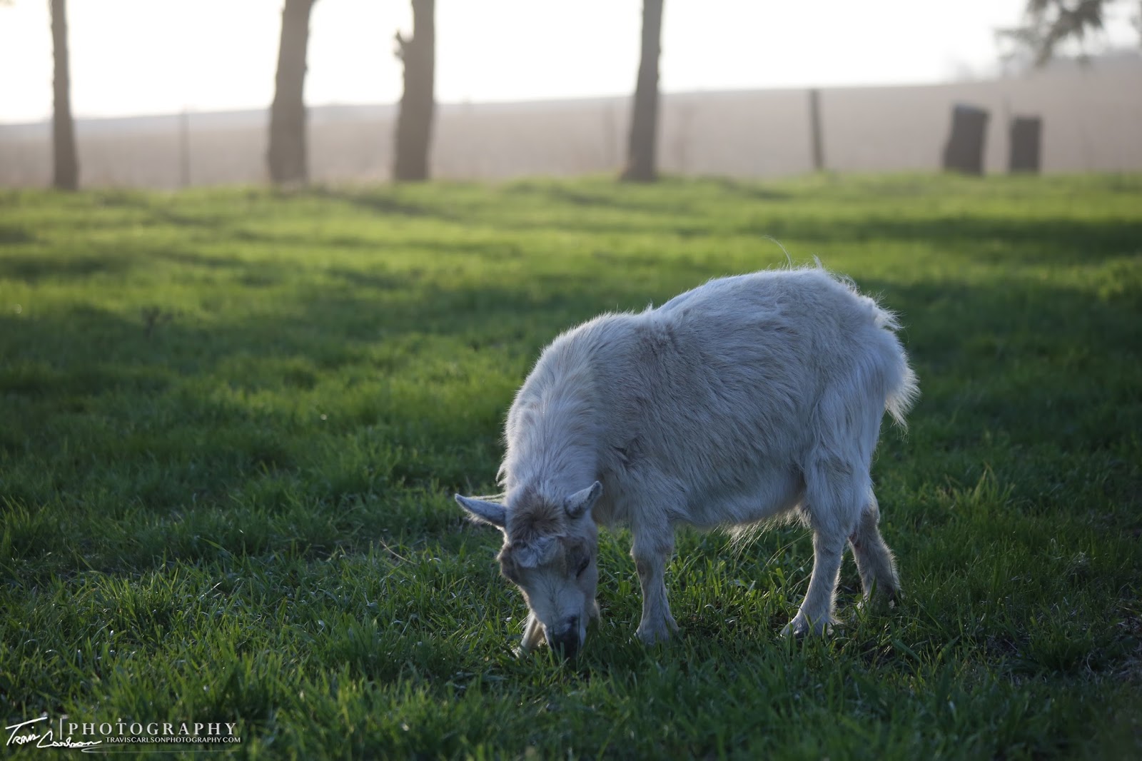
Dana, our last remaining goat grazing in this pasture!
Another good shot of Dana in our pasture...
A close-up of Thunder!

That's all for the pets. Next up are some storm chasing posts I'm working on as I spent most of late April and May chasing severe storms locally in Illinois and Iowa. Those will be posted in the coming days.

Tuesday, May 27, 2014

04/21/14 Underneath the Stars

A lighthouse amidst starry skies outside Kewanee, IL

Last month, I was able to break in my Canon 5D Mark III and my Canon EF 16-35mm f/2.8 L lens for some astrophotography. I shot all of these photos outside my hometown of Kewanee, IL in rural-Stark County, IL. My first impressions are quite good with both the camera and lens. I'm quite impressed with the quality in low-light situations and higer-ISO's which was expected when I upgraded to a full-frame sensor camera. Over the last few years I've become more and more interested in photographing the night sky. It's amazing what you can do with the night sky in terms of photography and what you can observe. Anyhow, on a few nights I used my parent's outdoor lighthouse (a favorite of mine) to get a few test shots with this camera. I've added a few photos I shot below:

Light painting the foreground a bit with a flashlight in the backyard...
The stars "popping" out between cirrus clouds!
More light painting to get the lighthouse to "pop" in this photo...
A rather neat wide-angle perspective!
This was a cold clear spring night with no moonlight present...
Another close-up of the lighthouse!
The lighthouse and the pool enclosure have definitely provided some great photos over the years...

After a couple nights testing out the low-light capabilities with this camera I moved on to some more photography over the next few weeks and some storm chasing as well. I'll update with those posts soon.

Monday, May 26, 2014

04/21/14 Spring Sunsets

A farmer tills this farm field preparing for planting as the sun begins to set southeast of Kewanee, IL

Last month, I shot a few sunsets in my hometown of Kewanee, IL on my down time. Over the last couple of months I've been very busy as of late in terms of photography, but not so much in terms of storm chasing. I have chased a few local setups over the last few weeks, but still have yet to make the trip to the Great Plains. Put simply, I've turned down some decent marginal chase days in the Western High Plains over the last week or two to hold out for June. Hopefully, this pays off but I'm not getting too optimistic yet. Only time will tell. Anyhow, I'm just now starting to get caught up on posts over the last month or two. I've added a few sunset shots I shot last month below:

A rather peaceful spring sunset!
"Farming at sunset"
"Spring green"
Beautiful sunset in the western horizon!
The setting sun peaking through these evergreen trees...
A lighthouse and the colorful sunset!
"Dusty sunset"
Some nice contrast!
Evergreen trees and picturesque colors...
I ended up getting covered in dust after taking this shot...

That's all for this post. I still have a good "chunk" of posts I'm currently working on and I'll be catching up on them asap over the next week. Stay tuned.