Friday, May 14, 2010

05/07/10 Mother Nature's Birthday Present

Mother Nature providing a spectacular
lightning show southwest of Kewanee, IL

Last Friday (my birthday), which feels like forever ago in the "weather world" featured a warm front that preceded to get very active shortly after midnight with a brilliant lightning display here in west-central Illinois. This presented my first real opportunity to grab some lightning shots this season and on this night the storms sure were prolific lightning producers. Thanks to an abundance of elevated-CAPE and even some storms getting surface-based along the warm front their were an abundance of intense CG's to observe. I set-up shop after midnight in the backyard as the storms approached from the southwest near the Mississippi River moving northeast. I thought I'd easily be able to get a few photogenic lightning shots which ended up being the case as the thunderstorms approached. One of these storms upon arrival became severe-warned with 60+ mile per hour winds being reported near Monmouth, IL and Galesburg, IL well after midnight. Quite impressive as instability tends to decrease in the early morning hours after midnight. Anyhow, I managed to get several good shots that I ended up happy with. You know you're seriously into severe weather when you are out past midnight on your birthday doing storm photography rather than well you can imagine...or maybe that's just the weather geek in me talking? Hmm...wait don't answer that ;) We also ended up with easily 2" inches of rain from this system which would later cause flooding problems the following week. I added several photos from the night below:

I thought this bell (foreground) created a
good photo-op as the lightning approached my location
I'm a big chicken when it comes to lightning
(this one sure got my attention rather quick)
Followed-up by yet another intense CG stroke
(storm actually becoming severe-warned at this point)
This convection sure was fun to photograph
I'm more of a storm structure photographer myself, but photographing lighting ranks pretty high on my favorites-list when it comes to photography
Yet another intense CG stroke
nearly in the
same location as many above
One of my favorite shots from the night!

Mother Nature sure gave me a nice birthday present last Friday...okay...yes...it wasn't a supercell, but hey I'll take a gorgeous lightning display every now and then too. I'll update later with another post as this past Sunday I made the long drive to Kansas for Monday's HIGH risk and almost sure "wedgefest" in the Great Plains. It ended up being a frustrating day at least for myself...Stay tuned.

Saturday, May 1, 2010

04/30/10 MDT Risk Fail

Photogenic thunderstorm becoming
severe
at sunset in Peoria, IL

Friday, featured a MDT risk of severe weather across much of the Midwest extending through the Deep South. By mid-afternoon, I found myself targeting a Burlington, IA-to-Monmouth, IL line as convection along the cold front created a differential heating boundary. Destabilization quickly began to take place to the east of this boundary in west-central Illinois. By mid-afternoon a Tornado Watch was already in place with strong shear and some backing winds at the surface which surely couldn't be overlooked hence the reason for the Tornado Watch issuance. With that being said, even with moisture streaming north from the Gulf of Mexico with 60-63°F dew points common; instability (CAPE) still lacked across the risk-area in west-central Illinois. Also, by mid-afternoon thanks to a strong low-level jet thunderstorms continued to erupt behind the cold front in Missouri and Iowa with the convective debris (anvil shadow(s)) overspreading the destabilizing area-of-interest. This really in turn limited the severe weather threat in my opinion as well as weak forcing. If we could have got surface temperatures into the 80's we might have had quite a severe weather outbreak on our hands locally. I traveled most of the day farther and farther south to try to tap more instability and deeper moisture and by 5:00pm I decided to give-up all-together on the day near Jacksonville, IL. It just didn't appear their was enough instability to get development ahead of the cold front yesterday. As I began the roughly 3-hour drive home...some storms started to get their act together as I neared Lincoln, IL to my west-southwest. Since these storms looked the best of the entire day I decided to drive right into them along I-74 as they traversed through Peoria, IL. At first glance driving into Peoria, IL these looked rather unorganized, but as I got right up next to them my opinion quickly changed. These storms quickly matured into a nice bow-echo feature on radar to my west/southwest. I quickly found an exit along I-74 to do some quick storm photography since this convection was hauling-a** at around 50mph. This feature actually was quite photogenic when it made its appearance a few miles away from my location. As this bow-echo passed to the northeast it quickly went severe-warned which didn't surprise me at all after observing it 20 minutes prior. After taking some photos and being somewhat happy to not leave the day empty-handed per-say I headed home for the night. Here are some photos below as the convection (becoming severe) approached Peoria, IL:

After a little (core-punching) I took this photo
at sunset behind the departing severe convection

Overall, this chase day was a disappointment and not what I had imagined the night before, but I'm happy I ended the day with some rather nice convection however. The fact that April is over and the "peak months" May and June are upon us doesn't make me dwell too much on this disappointing April I've had. Here's to adequate shear + rich-moisture + extreme instability, monster supercells, wedges, adequate storm speeds, and chase-able terrain that May and June has to offer...

Thursday, April 29, 2010

04/23/10 Nebraska Bust

Strong thunderstorm trying to become supercellular
initially north of Nebraska City, NE

Last Friday, I ended up making the long drive to SE Nebraska and targeted Nebraska, City, NE. It would turn out that last Thursday and Saturday would prove to be the real "tornado days" with several large tornadoes in the Deep South especially on Saturday, but work obligations forced my hand to chase Thursday's setup along the warm front in Nebraska instead. Friday's chase quickly went down the tubes though as it appeared instability was lacking even though the RUC model seemed to indicate that it wasn't by late evening. A cap helped to suppress convection from forming all afternoon until after 5:00pm when the first "blips" showed up on radar as the cap began to weaken. Shear-wise this area was indeed favorable for supercells and LCL's were quite low along the warm front, but it would turn out that instability would be the limiting factor as well as low-level moisture. Nevertheless, I sat most of the afternoon in Nebraska City, NE waiting for initiation in the evening. After 5:00pm agitated cumulus (CU) could be observed as convective inhibition was weakening. This area also was hanging onto SE winds during the evening and dew points near 60°F and with the help of a subtle shortwave convective initiation began. The first cell actually developed overhead of me in Nebraska City, NE and headed off to the north/east. I preceded to jump on I-29 to catch these couple of cells staying away from the traffic congested Omaha, NE-area. On a few instances these storms looked really good, but appeared that the shear was a tad too much for them as they really couldn't maintain their updrafts for very long. After taking a few photos here and there of the disappointing convection near sunset; I began to make the long drive home with work the next morning knowing any supercells/tornadoes would be hard to come by. With that being said I've added some photos from the chase below:

Convection along I-29 in western Iowa 
Agitated cumulus (CU) in Nebraska City, NE
Convection beginning (Canon telephoto-zoom lens)
Wide-angle shot of the best storm
(structure-wise) of the evening

Initiation was within the hour here...(above)
My mobile weather station with convective
initiation occurring overhead
(pretty sweet)

This scud cloud was rather photogenic in the vertical

I added a short YouTube clip just before storms
initiated in Nebraska City, NE (above)


That's about all for this chase log...April has surely been a disappointing month thus far at least for myself. Yet, it hasn't been for a lack of trying, but thus far the storms haven't cooperated since not all the ingredients have been coming together unless you chased last Thursday or Friday in the "favored-areas". The question is whether May and June will be spectacular or not when it comes to severe weather and tornadoes...I'm not convinced yet, but I remain hopeful though...

Friday, April 9, 2010

04/06/10 April Fools in Iowa

Supercell west of Cedar Rapids, IA

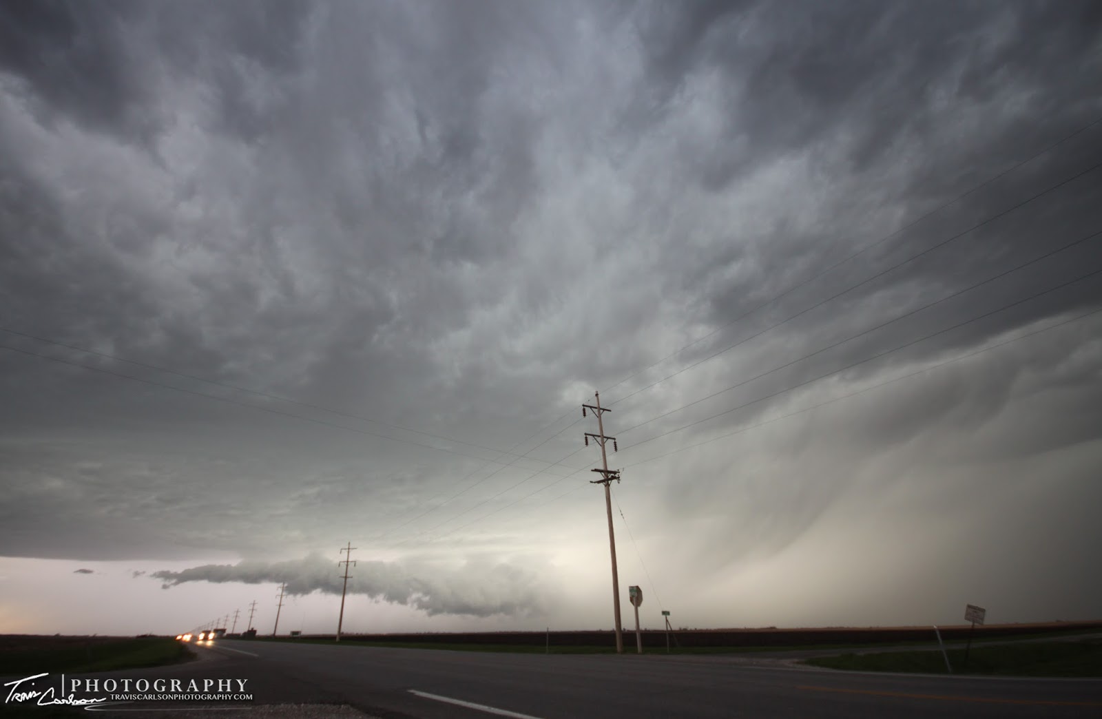
Tuesday, featured another chase day that held some true promise even with an ugly positive-tilt trough pushing through the Midwest. But hey can you really give up on a warm front in the Midwest in April? Well, probably not if you had a day-off from work! My plan for the day was target the warm front/triple point northeast of Des Moines, IA where it seemed had the best supercell/tornadic promise. For the life of me I wasn't going to play a southern target with southwesterly winds at the surface...yuk! So, I found the area with the greatest tornado potential on this day west of Cedar Rapids, IA which would hang on to some southeasterly-to-southerly winds a tad bit longer through the day and wait for convective initiation along the warm front. This was quite a warm front (55°F in Waterloo, IA while maybe an hour to the south in Cedar Rapids, IA it was 80°F). By late-afternoon, the tornado potential seemed like it was decreasing as each storm went up and struggled to latch on to the boundary (warm front). With that being said, I remained patient which is new to me. Usually, I jump right on whatever goes up, but the trick is to make a confident decision with all the information at your disposal and stick with it. Due to the fact today's storm speeds were crappy to put it mildly you had to keep in the back of your mind if you jump on a storm you better have a hell of a good reason or you'll be out of position so quick when that storm does become the "right" storm to chase. As a tornado-warned cell to the southwest approached my location west of Cedar Rapids, IA (near Newhall, IA)...I figured it had the best tornado potential in my location. On a day like today you have to time it perfectly. What I mean by that: (basically guess within a few miles where it has got the best shot to produce a tornado and be there). Why? Well, once the storm passes you by you are very unlikely to catch it again. On a day like this you play more of a storm spotter role than a role of a storm chaser unfortunately. In general, fast storm speeds make chasing in April much more difficult than in May or specifically June when the jet energy isn't as strong. It would turn out that a few funnel cloud reports would later be reported 10 minutes after the supercell passed by me to the northeast. I tend to be skeptical of these reports however, as I observed a lot of turbulent scud with the low cloud bases that could be easily confused with a funnel cloud especially since this supercell appeared more outflow dominate than anything. Anyhow, I've added a few photos from the day below, but not as many as I'm accustomed to since this storm was not very photogenic:

As I waited for a storm to get itself rooted on the warm front
I took this time to test out my Canon telephoto-zoom

lens as convection began to build
Cap slowly weakening along the warm front
Supercell moving northeast at 50mph approaching
the north-side of Cedar Rapids, IA

In conclusion, the day had good potential, but the storms didn't cooperate and ride the boundary that myself and many storm chasers were hoping for. Their are more chases down the road however and hopefully May and June will make up for the disappointment over the last few days...

04/04/10 Easter Sunday Supercell

Supercell traversing east of Macomb, IL
on Easter Sunday last weekend

Well, last Sunday along with bringing the annual Easter eggs to many front yards in the local-area the Easter bunny brought some April severe convection to west-central Illinois as well. By midday, I ventured out the door and chased some wannabee thunderstorms along a weak disturbance in central Illinois getting a much needed car wash in the process. Later, I sat at home and nowcasted most of the day watching northeast Missouri and west-central Illinois very closely knowing any severe convection would be in reach by a few hours from my location. After seeing some ingredients coming together I pulled the plug and headed west to catch some embedded supercells along the cold front approaching from southeast Iowa. After 6:00pm I managed to reach my "sweet spot" east of Macomb, IL where winds were backing a little better in this area as the supercell with large hail approached from the west and this seemed at least in Illinois the area that could get one of those few "tor reports" on this day. As the storm approached, I observed a pronounced lowing below the updraft base as it moved across McDonough County, IL and specifically Macomb, IL. The lightning on this supercell was just crazy. I'm usually not one to shy away from standing out in the open to grab some photos, but this day was different with intense CG's so close I ran to the SUV on more than one occasion doing more picture-taking in the truck than out in the open. After taking some photos and some time-lapse video I preceded east and than rode the storm out east of Macomb, IL. This is when I observed a fantastic roll cloud as the storm weakened. Due to the fact that storm speeds were not cooperating on this day I had to let the storm go at my discretion. That's the one main reason I tend to not do a lot of "April chasing" because it makes chasing any storm that much harder with a screaming jet stream aloft this early in the season. Sure enough as I let the storm pass it gains some steam again going tornado-warned for the first time near the Illinois River...which just goes to show you the environment at least near my location was indeed favorable. I've added some photos from the day below:

Easter egg hunt anyone? (macro-lens)
Supercell produces another lowering here that transitions
into a horizontal roll cloud as it passes overhead

Supercell has now passed to the east
Sunset, behind the convection as I call it a chase at sunset
Guess we will wrap up this post with
more of a Easter-feel to
it

I've added a short YouTube time-lapse (above)

Overall, the day had promise indeed and it was nice to observe some sweet convection and key features again after a winter that felt like being in hibernation in this area. Monday, also had some potential of a chase however, I had to work and felt the cap (lid) would not break in southern Iowa and Missouri, but after work I kept a close eye on southeast Iowa and northeast Missouri as the cap was a bit weaker in that area and this location is where I felt had the most promise of convection, but even here I didn't bother driving to this area knowing a bust was indeed likely. Tuesday, I had a day-off which meant a chase was again in store as finally the upper-level trough pulled east bringing some "sleeper potential" to portions of Iowa. I'll update that chase log here in a bit...