

Well, last Sunday along with bringing the annual Easter eggs to many front yards in the local-area the Easter bunny brought some April severe convection to west-central Illinois as well. By midday, I ventured out the door and chased some wannabee thunderstorms along a weak disturbance in central Illinois getting a much needed car wash in the process. Later, I sat at home and nowcasted most of the day watching northeast Missouri and west-central Illinois very closely knowing any severe convection would be in reach by a few hours from my location. After seeing some ingredients coming together I pulled the plug and headed west to catch some embedded supercells along the cold front approaching from southeast Iowa. After 6:00pm I managed to reach my "sweet spot" east of Macomb, IL where winds were backing a little better in this area as the supercell with large hail approached from the west and this seemed at least in Illinois the area that could get one of those few "tor reports" on this day. As the storm approached, I observed a pronounced lowing below the updraft base as it moved across McDonough County, IL and specifically Macomb, IL. The lightning on this supercell was just crazy. I'm usually not one to shy away from standing out in the open to grab some photos, but this day was different with intense CG's so close I ran to the SUV on more than one occasion doing more picture-taking in the truck than out in the open. After taking some photos and some time-lapse video I preceded east and than rode the storm out east of Macomb, IL. This is when I observed a fantastic roll cloud as the storm weakened. Due to the fact that storm speeds were not cooperating on this day I had to let the storm go at my discretion. That's the one main reason I tend to not do a lot of "April chasing" because it makes chasing any storm that much harder with a screaming jet stream aloft this early in the season. Sure enough as I let the storm pass it gains some steam again going tornado-warned for the first time near the Illinois River...which just goes to show you the environment at least near my location was indeed favorable. I've added some photos from the day below:

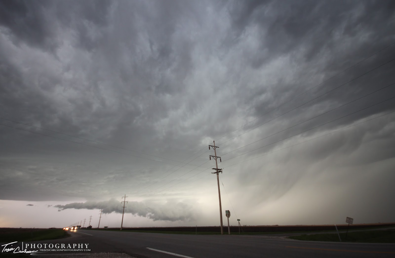
Supercell produces another lowering here that transitions
into a horizontal roll cloud as it passes overhead
 Supercell has now passed to the east
 Sunset, behind the convection as I call it a chase at sunset

into a horizontal roll cloud as it passes overhead
Guess we will wrap up this post with
more of a Easter-feel to it
I've added a short YouTube time-lapse (above)
more of a Easter-feel to it
I've added a short YouTube time-lapse (above)
Overall, the day had promise indeed and it was nice to observe some sweet convection and key features again after a winter that felt like being in hibernation in this area. Monday, also had some potential of a chase however, I had to work and felt the cap (lid) would not break in southern Iowa and Missouri, but after work I kept a close eye on southeast Iowa and northeast Missouri as the cap was a bit weaker in that area and this location is where I felt had the most promise of convection, but even here I didn't bother driving to this area knowing a bust was indeed likely. Tuesday, I had a day-off which meant a chase was again in store as finally the upper-level trough pulled east bringing some "sleeper potential" to portions of Iowa. I'll update that chase log here in a bit...