

across much of the U.S. including Peoria, IL
Over the last couple of weeks I've shot a few photos of the on-going severe drought in the local-area around Peoria, IL that may go down as a historic drought for the U.S. The current drought monitor for the U.S. can be found here. Closer to home, portions of the Midwest are also in a severe drought as well seen here. For the year, Peoria, IL has around a 9" inch deficit in terms of rainfall. This drought started during the spring and has worsened over the summer in this area. Last winter was quite dry in this area as well. Many have asked why haven't we had much in terms of severe weather here in Peoria, IL. Well quite frankly you might as well blame the drought. With much of the U.S. in a severe drought our severe weather season has been quite tame compared to years past. The reason can be explained by analyzing the jet stream. It got pushed north into Canada far earlier in the summer than is typical. This has allowed a stubborn ridge of high pressure in the Great Plains to become nearly stationary creating a nice heat dome earlier in the year. This heat dome has been quite persistent keeping the storm track well to the north where we only get periodic chances for severe weather in the "ring-of-fire" as weak cold fronts drop down in a northwest-flow regime from Canada. Since the heat has been very persistent we have also lost a lot of soil moisture as well which just heats up the ground faster leading to more 100°F heat. All of these factors contribute to the lack of severe weather. Tornadoes over the last few months have been well below-normal across the U.S. as well. It doesn't surprise me and it shouldn't surprise you either because that's to be expected with the above mentioned factors. It's why Canada is on pace to set a record for tornadoes this summer! Anyhow, I don't foresee any "drought busting" storm system's in the near future. We will have to wait for the late-fall and winter to try to make up this deficit. The good news, I think we will! I'm usually not an optimist by any means, but I believe this winter will be really "interesting" here in central Illinois. I caution you though as long-term forecasting is about as accurate as throwing a dart. That's the damn truth! However, after a tame winter last year I think this winter will make up for it in terms of precipitation, but trend more toward normal for temperatures. We'll just have to wait to see how that prediction pans out. The scope of this drought has really surprised me and was quite unexpected this summer. I've added photos below of the severe drought conditions present in the local-area below:

Illinois farm field!
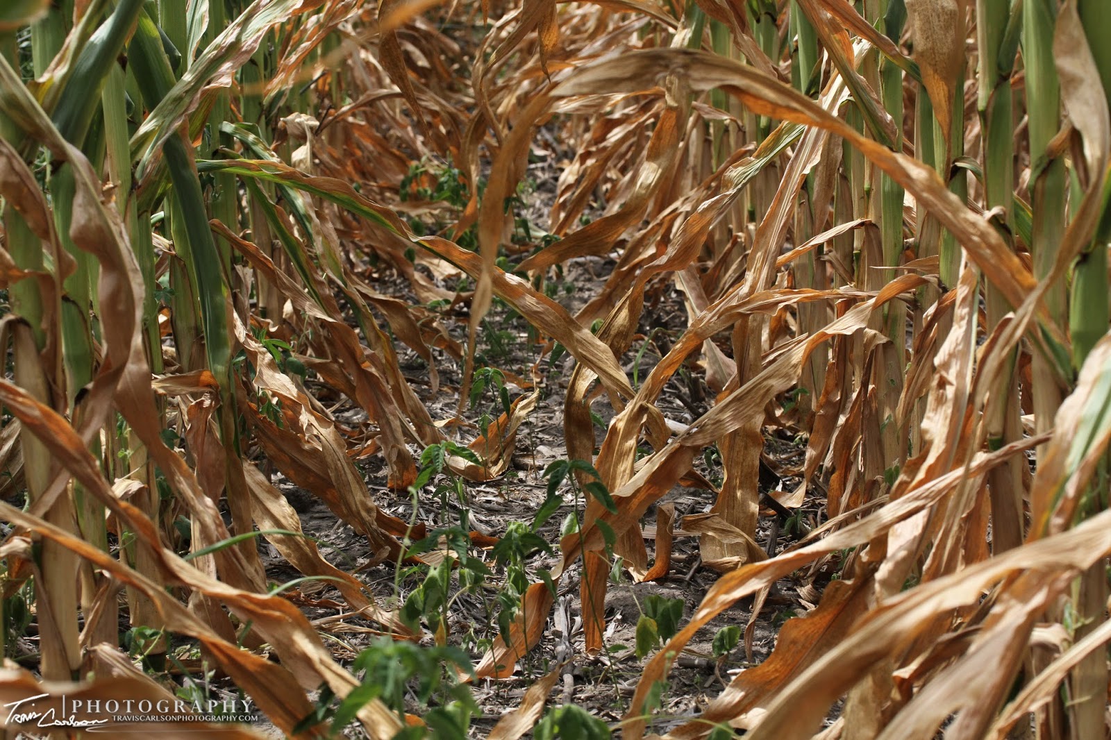
The corn crop this year is pretty pathetic
across the breadbasket of the U.S.


A tough year for farmers to say the least...

A great photo of the ground cracking seen here (above)
a typical sign of drought conditions...

A scorching summer sunset in rural-Stark County, IL...

The drought is so bad that this farmer gave up
and mowed down some of his corn crop!

The drought of 2012 is sure to go down
as one for the record books...

One last photo as the corn crop is basking
in the intense summer heat!
That's all for now. I'll update as time permits. Hopefully, we will get some much needed rain soon as we start to inch closer and closer to fall. Hard to believe summer is nearly over already as the days are already getting shorter in terms of daylight. Stay tuned for future posts.