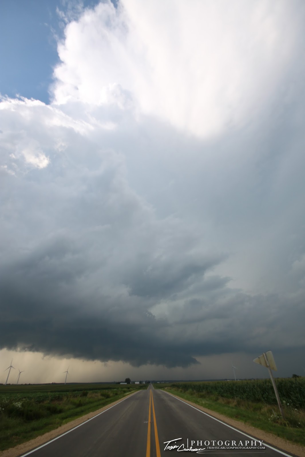
Sunday, I managed to get a nice reward for my patience. I spent most of Sunday afternoon monitoring the weather situation in the local-area as the previous night's model-runs showed some hidden tornadic/supercell potential in southeast Iowa and west-central Illinois. Sure enough shortly after 5:00pm a t-storm developed near Cambridge, IL. I quickly got out the door and began to hit the road to get in some late-evening storm photography. In the back of my mind I knew that their was a possibility to get some hidden surprises out of this local-chase or for that matter some picturesque photography near sunset. Why? Take a look at the marginal ingredients: CAPE (instability), 0-6km shear, and a moist boundary layer (70°F). I headed north out of Kewanee, IL on IL-Rt. 78. As I headed north a new storm initiated directly over Kewanee, IL to my south putting me out of position for the time being. This meant a core-punch folks! I punched through the core south of Neponset, IL and this was where I first got a view of a developing supercell along IL-Rt. 93 west of Bradford, IL. I then headed south (in a hurry) to a local wind farm south of Bradford, IL along IL-Rt. 93 as the storm turns right. I sat near this wind farm for a good while taking some time-lapse video and of course I photograph the structure of this supercell. I was rather happy with my reward from good ole' Mother Nature to say the least. This supercell continued east and I grabbed more structure shots as it became outflow dominate just before crossing the Illinois River where I finally let "her" go. A great chase for one of those marginal day's for myself! I've done great this year on these marginal days, but left always disappointed on the "big" days this year for some reason or another. It should be the opposite right?! Oh well, I can't complain...especially since I've had a knack of getting rewarded this year when everyone else stays home...I've added photos and a time-lapse from this local chase day below:
One of those "whoa" shots...
Supercell progressing southeast in rural-Stark County, IL
Portrait-view of the rotating updraft
Wall cloud tries to produce here but just not enough
low-level shear for tornadogenesis folks
More structure just farther south and
east near Camp Grove, IL
Supercell becomes outflow dominate (above)
Picturesque and rewarding storm
on an otherwise "marginal" severe weather day
Awesome rain/hail foot!
Double rainbow!
Illinois vegetation and rainbow Stellar rainbow as I stay away from the 3/4 inch hail
The sun sets on a battle-scared pine tree
from a previous severe weather event
I've added a YouTube time-lapse from the chase (above)
from a previous severe weather event
I've added a YouTube time-lapse from the chase (above)
That's all for this chase day for the moment. I'll be adding another chase log here in the coming days from this Monday as I once again found myself chasing another marginal severe weather day here in the local-area . Stay tuned...


