

of a busy fall chase day outside Elkhart, IL
On September 21st, I ended up chasing in central Illinois after eyeballing a potential chase a couple days before this particular day. The setup appeared more that adequate for supercells and tornadoes early that morning along an advancing warm front as a shortwave trough and low-pressure system would provide enough lift to create supercells by mid-afternoon. By noon, I was already heading south with an initial target of Broadwell, IL. This target featured backed surface winds along the front and was also along a differential heating boundary that set up with cool stable air to the north near Peoria, IL. Storms fired along the front during the early afternoon, but remained relatively outflow dominate, but I did chase one of these severe-warned thunderstorms northwest of Clinton, IL. This storm was largely outflow dominate, but I was able to grab a few good pics and time-lapse video. I quickly headed back west though as my attention turned to a weakening cap along the Illinois River. This area was characterized by around 1,000J/kg of CAPE, 0-6km shear at 70kts, 0-3km SRH at 300m2/s2, and a moistening boundary-layer with dew points near 60°F ahead of the low-pressure center. With backing winds also in that area I knew I had to head west out of Lincoln, IL toward the town of Middletown, IL. By this time, new convection was beginning to develop to my west that began to get more and more organized. I stopped a few times to snap a few photos, but spent most of the time watching a developing supercell continue to organize as I took in the view east of Athens, IL along U.S. 29. I watched a wall cloud quickly lower and gain more and more low-level rotation so I quickly headed east along U.S. 29 knowing I was a little too close for comfort. I pulled into the town of Cantrall, IL seeing some pretty rapid motion in my rear-view mirror so I pulled over to nearly witness a tornado form over this small town. It got close a few times. I ended up getting blasted by a RFD on the back-side which told me this was pretty close to producing. It was a strong enough RFD that corn-husks went in a nice circular motion along with dust in the field to my east and my reading glasses flew off my head. Kind of was a crazy moment! After finding my glasses in the field I quickly followed this strong supercell just north of Springfield, IL. It tried to drop a tornado a couple times, but it just wasn't enough. After seeing this storm progressively become outflow dominate I preceded to stay on the back-side of the convection to take some shots of the departing convection. This was rather rewarding with back-lit storms providing picturesque landscapes and rainbows for most of the evening. I headed back north meeting up with a fellow chaser/photographer Chris Kincaid along I-55. We both headed west and shot a few more photos at sunset as more convection was moving-in. I then called it an evening and headed back pretty happy with all things considered as I was definitely on the right storm on this particular evening. Photos and some time-lapse video I have posted below:


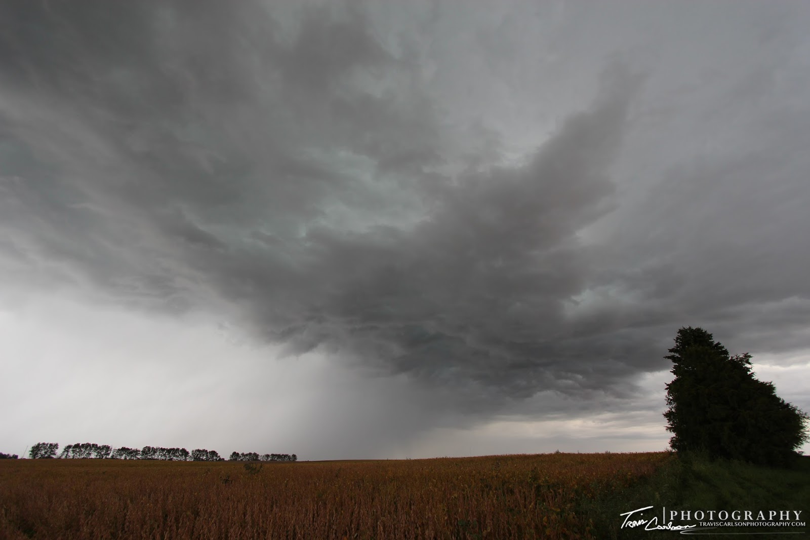
Beautiful early-fall convection!

Spooky looking sky off the first storm of the day
Shear funnel (left)!

Closer-view...

Pretty cool shot with this severe-warned
storm gusting out...

And another...
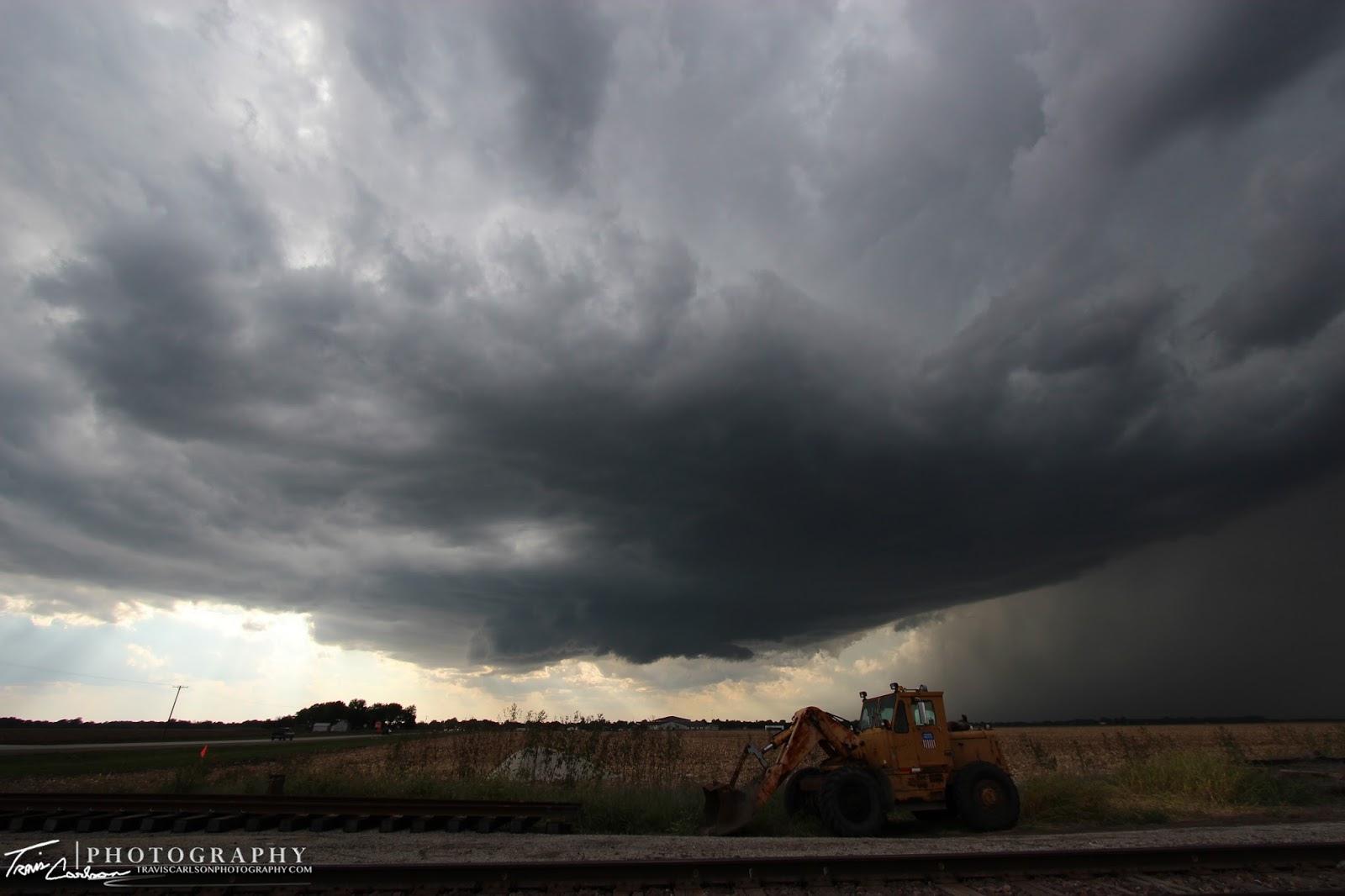
Departing convection with a tractor
ready for harvest (right)!

This tractor provides a good photo-op
with the departing convection...

with the departing convection...


Trying to quickly wrap-up now!

Oh, she's so close...

Circulation becoming rain-wrapped as the
RFD blows off my glasses here...

A few minutes later I keep up and it nearly
produces again along this highway!

Becoming outflow dominate now...

A cool perspective here!

One of my best wide-angle shots of the year!

Weird looking blue tint in these agitated cumulus...

Closer-view!

Looking back at the supercell that nearly
dropped a tornado earlier...

More picturesque convection near sunset!

Shelf cloud moving overhead just west of I-55...

A beautiful sunset in the western horizon as
convection begins to move overhead!

Driving off into a fall stormy sunset...

A cool perspective as I setup along a highway
to take some photos at sunset of the convection!

Beautiful sunset on this evening...Love this shot!

One last photo in the eastern horizon as the
sun sets on this chase day...
I've added a YouTube time-lapse (above)
This was quite a rewarding chase. One of my favorites of the year and it comes in September of all months. Oh well, you never know what Mother Nature will have up her sleeve. I'll be out shooting fall photos over the next few weeks for my 2012 fall collection. I'll post those photos over the next month or so. Until then...