Wednesday, January 27, 2010

01/20/10 Ice Storm in the Midwest

Ice storm causing many travel and power problems
in Kewanee, IL (Wed-Thurs.)

Last Wednesday, a classic ice storm took shape across Iowa and portions of west-central Illinois. Some areas in Iowa received near a half inch of ice accumulation especially near Des Moines, IA. Closer to home in west-central Illinois many areas received a quarter inch of ice accumulation with areas around Kewanee, IL receiving between .15-.25" of an inch of ice accumulation. As you can imagine this created many problems around the area causing terrible driving conditions and widespread power outages. During this freezing rain event we were lucky enough to not lose power Wednesday even with a strong east wind snapping many tree limbs. Thursday, was a different story however. After lots of "flickering" the previous night we finally lost power in my area. Nearly a 7-hour outage here with areas to the west being without power for nearly 24hrs. especially in Mercer County, IL. So why did we get this ice storm this past week?...well we couldn't get rid of the melting snow pack due to persistent fog the previous weekend...this helped to create a shallow cold-layer near the surface. A high pressure center with it's clockwise rotation also helped to keep temperatures at or just below freezing as well thanks to the easterly component of the wind during the event. Think of the top-down approach if you have a meteorology background...falling snowflakes from the clouds above hit a warm-layer near 850mb which allows the snowflakes to melt forming raindrops. As these raindrops fall to the surface they encounter a shallow cold-layer...the raindrop cools below 32°F and freezes on contact to any surface below 32°F creating an accumulation of ice. Power lines, trees, and outdoor surfaces usually brunt the heavy load of the ice accumulation. This added weight due to ice accumulation on power lines and tree branches can and often snap tree limbs which fall onto power lines leading to power outages. The more ice accumulation and/or high wind speeds...the higher likelihood of a power outage during an ice storm. Anyhow, I documented this ice storm in the local-area and since I haven't done some "town photography" and I have really used up many photo-ops in the backyard this winter...I ventured all around Kewanee, IL Friday to get some "town/city ice storm shots". I was hoping to get some night shots as well Friday night, but sure enough in less than 6 hours it all melted...doh! I've added some hand-picked photos however below:

Textbook example of how you should
measure ice accumulation

Street signs provide great photo-ops after an ice storm...
Alright, I finally took the lights down, but before
I did
I snapped this photo after the ice storm
Snow plow trying to keep up, salting many highways
Heavy ice accumulation here...
(particularly trees oriented north-south)

I actually shot this on our rural-road maybe a mile or two away
East-facing garage...it's obvious why garage doors
don't
open in these events routinely
What's incredible is how uniform the
ice can
get on these street signs
Wind vane coated in ice as well...
Most roads were in decent shape...however try driving down some
rural-roads after these events...
(You'll be probably cursing up a storm)

Power line encased in ice... hence why many lose power folks...
Even the lawn is somewhat picturesque as
well and
not to mention a tad crunchy too
Macro-lens shot...this lens works wonders in the winter season
Home sweet home...only about 41% of Ameren customers
in this
county were without power Thursday...
Probably my favorite rural-area shot from this ice storm
Power lines still coated with ice here in this small valley
Along Rt. 78 looking south (this highway actually was a joke until this
past
fall when the stimulus money arrived)
Farm in the background with ice coated Willow trees in the foreground
Black Hawk East College

This begins another section of ice storm photos from Kewanee, IL within city limits. Like I said I am still kicking myself for not getting some night photography photos..argh!

From pure observation it appears Kewanee, IL had
more ice accumulation than I expected (.25")

Simple Walmart carts showing the after effects of the ice storm
Stoplights glazed over...
Street sign and an ice coated tree
New hospital on the southwest-side of Kewanee, IL
Ok, not the "going green" a storm chaser is thinking of...
What do you know...power crews are on the scene
Close-up...looks like their were some serious problems here...
Main St. for some reason I'm thinking of the "disconnect between
Wall St. and Main St." or maybe
that's just
my political nature talking...hmm
This shot would have been 10x better with some sunshine
I thought this shot was interesting with an ice coated tree
taking up the (foreground) with a street
name
sign in the (background)
Another stop light with the icy glaze...
(again would have been spectacular at night) grr...
Willard St. outside Wethersfield High School
where I graduated what feels like forever ago (2004)
You can find these photo-ops everywhere you seemed to look...
Beach St. seems like a dumb name for a street in the Midwest
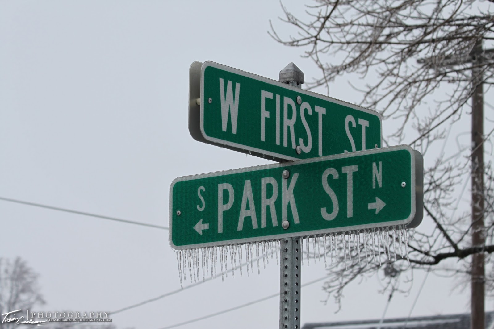
One more street name sign for the day

I've added a short YouTube clip illustrating
the thaw this past Friday (above)

Well that's all for now...besides the cold here in the Midwest the weather should be pretty dull over the next few days except if you're located in the Southern Plains and Deep South. That's where another ice storm could be found along with some severe thunderstorms as well. I'll be making a short stop to South Bend, IN in the coming days...so I'll probably update at some point with some photos when I get back...

Monday, January 18, 2010

01/17/10 Freezing Fog

Winter beauty on our notorious tree-line
for
spectacular photos outside Kewanee, IL

Freezing fog developed across much of eastern Iowa and west-central Illinois Saturday night reducing visibilities in many areas and creating some slippery travel on roadways. This freezing fog also created some dramatic winter scenes as well come Sunday morning. For those unfamiliar with freezing fog...it occurs when the air near the surface has dew points just below freezing. This can cause a deposit of interlocking ice crystals as the sublimation process changes vapor directly into a solid phase in these rare events. If you have fog than theirs a possibility you have supercooled water droplets (water droplets below the freezing point) and if these stick to any surfaces you can get dramatic rime formations as well. Another similar type of frost is hoar frost, but this usually occurs on cold clear nights instead (radiation frost). The last instance when freezing fog occurred in Kewanee, IL was December 2007. In that case...the sun popped out and created a few dramatic shots with the deep blue morning skies. Actually, I remember this event like it was yesterday since it was the first time I used a DSLR camera. This past Saturday we lacked the sunshine however...but still some incredible winter scenes were found again which usually accompany these freezing fog events. Anyhow, I wandered around the backyard to find a few photo opportunities to illustrate this such event below:

I swear I've taken this same photo 3 or 4 times
in
different winter situations this winter
i.e (Heavy snow, icing, hoar frost, and now freezing fog)...

Barbed wire fence with the interlocking ice crystals
Evergreen tree with the above mentioned
Amazing...even in January to find a "two seasons-in-one shot
Benefit of living in a rural-area...
(fence posts and wire-fencing can create some awesome photo-ops)
I'm pretty sure the Winter Solstice has passed right?
Pretty cool stuff...(macro-lens)
Another Evergreen tree shot...

As far as the weather over the next few days across my hometown...it looks like an icing event could be in store by midweek with models showing a classic freezing rain scenario...afterwards attention will turn to the upcoming weekend as I mentioned in a previous post. A powerhouse storm should develop in the western U.S. and will track across the central U.S. It appears currently we are looking at mostly a (significant) heavy rain event in this area which could cause some flooding issues...

Tuesday, January 12, 2010

01/07/10 Alberta Clipper Winter Storm

A foot deep snowdrift after yet another winter storm here in Kewanee, IL

A rather impressive Alberta Clipper produced yet another significant snowfall in the Midwest and in my hometown of Kewanee, IL. High LSR's (liquid-to-snow ratios) allowed accumulating snow to quickly pile up. Also, the presence of 200mb deep-layer saturation in the optimum -12 to -18°C ice crystal growth zone produced dendrite snowflakes during this winter storm. Locally, we received 5.0" inches of new snow accumulation by midday Thursday with 1.0" inch of additional snow accumulation as the wrap-around deformation zone rotated through Kewanee, IL bringing the storm total to 6.0" inches of fresh snowfall. Quite impressive for an Alberta Clipper! Some areas even picked up 6-10" inches as well just to my southwest in Galesburg, IL and parts of west-central Illinois. Another secondary heavier band also set up toward Dubuque, IA along the IL/WI border thanks to the lingering deformation zone Thursday. Northwest winds 20-25mph as the clipper pulled-away created extensive blowing and drifting of the snow especially in rural-areas after the storm. On another note, I recently joined the Significant Weather Observing Program (SWOP) at ILX to help the local NWS office out with snowfall totals etc. You can observe my snowfall measurements as well as other SWOP members during significant events here. I've included some photos from this winter storm below:

Icicles galore on our roof
Brilliant blue skies after this winter storm
Stark County, IL snowplow trying to clear north-south roads
that were hard to handle thanks to extensive blowing and drifting

Snowdrift along our fence
Snow scape shot as the sun makes an appearance
4-wheeler in action plowing the driveway
Icicle, creating a really picturesque reflection
More and more drifting snow...
The garage pretty much drifted-shut
New snow accumulation obvious here
...before the northwest winds kicked-in
I guess you could call this a snow fence
Icicle palace on the front of the house
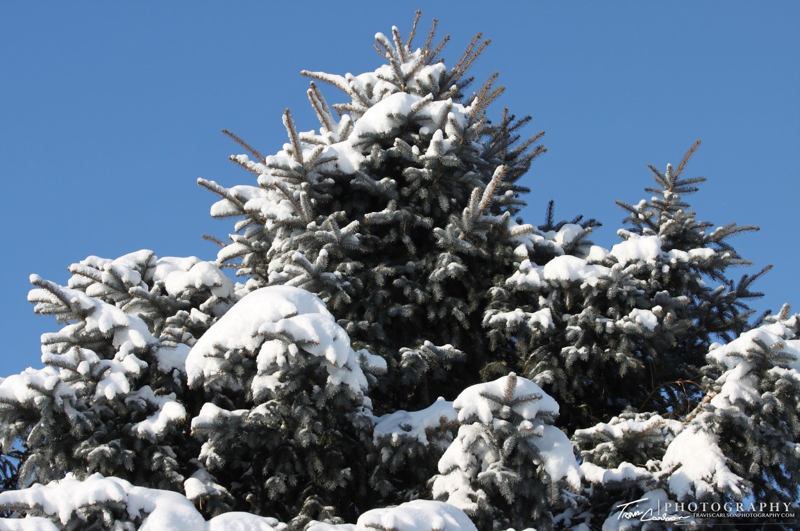
Evergreen trees glistening in the blue sky
after the heavy snowfall
Evergreen trees as if someone took a snow machine to them
Snow-covered roads all across the area
Got a few of these shots before the winds blew
all this fluffy snow everywhere
Calm winds during the winter storm plus the large dendritesnowflakes helped the snow accumulate to everything
Accumulated snow on the mailbox
Still haven't took down any of the holiday decorations...
well who would during this arctic blast that has lasted for weeks?
Set this shot up by trying to position myself so the sun
would back-lit the plant in the foreground
The snow machine (Alberta Clipper)
Wide-angle shot of the western horizon after the snowfall
Snow-blasted again...
Snowdrifts along this wooden-fence

Here are a couple wildlife shots I was lucky enough to grab while out photographing the winter storm below:

Cardinal in the fresh-snowfall
Blue Jay in the backyard

As far as the weather goes for the next few weeks it looks like we will finally be able to shake-off this cold spell and return to normal temperatures if not a tad above normal. I don't foresee any major snowstorms in the next week, but keep an eye out around the 24th of January (last week of January). Long-range models point to some type of a significant precipitation event near that type-period...

Monday, January 4, 2010

01/03/10 Arctic Plunge & Deep Freeze

Boiling water in -10° degrees Fahrenheit

The last few days have been quite cold in the Midwest. In Kewanee, IL we have bottomed-out as low as -10° degrees (Sunday morning) with wind chill values easily approaching -20° degrees below-zero. It's been much worse however in the Northern Plains and Upper Midwest thanks to an arctic high pressure center. It appears that the rest of this month will have below-normal temperatures throughout or at the very least the next couple weeks. With air temperatures below-zero I decided to pull out the annual pot of boiling water. For the photography aspect I used a wide-angle lens and I set the Canon T1i on continuous shooting and let the fun begin. Actually, I positioned the DSLR a tad downwind for most of the shots, but not too close. Ya, a little risky but it worked! The fun quickly ended though as in 15 min the DSLR and camcorder batteries died due to the extreme cold temperatures. They were fully charged beforehand...guess the instruction manual was indeed correct. Anyhow, got some of the shots I was hoping for. I've added some of them as well as some Hoar frost pics I took this past week along with the rare New Year's Eve blue moon. Photos are below:

Not much, but just a tad of Hoar frost
Hoar frost on some trees in a valley
Picket fence and some of the frost
Some of the crystals deposited overnight just above the surface
A liquid to a gaseous state
Back-lit sun creating my ghostly silhouette...pretty cool!
Fun science experiment during the "off-season"
How to make your own cloud...
Actually you can observe another phase-change as
crystallization seems to be occurring here

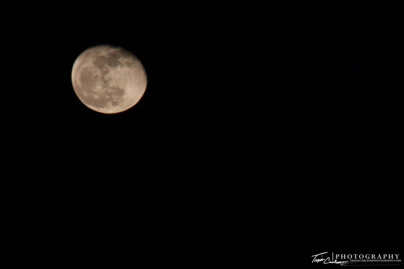
Here's a couple moon shots I took over the last week below: (Canon 70-300mm telephoto-zoom lens)

Brilliant New Year's Eve blue moon
(how rare you ask?...next time this will occur...2028)
Caught this spectacular shot Saturday night
(wind-farm lights in the foreground)


I've added a short YouTube clip as well (above)

Temperatures will slowly moderate somewhat over the next few days, but still well-below normal with another shot of accumulating snow in the Wednesday-Thursday time-frame. 2010 has surely started off very cold for much of the U.S.