


measure ice accumulation

Street signs provide great photo-ops after an ice storm...

Alright, I finally took the lights down, but before
I did I snapped this photo after the ice storm
 Snow plow trying to keep up, salting many highways
 Heavy ice accumulation here...
(particularly trees oriented north-south)
 I actually shot this on our rural-road maybe a mile or two away
 East-facing garage...it's obvious why garage doors
don't open in these events routinely
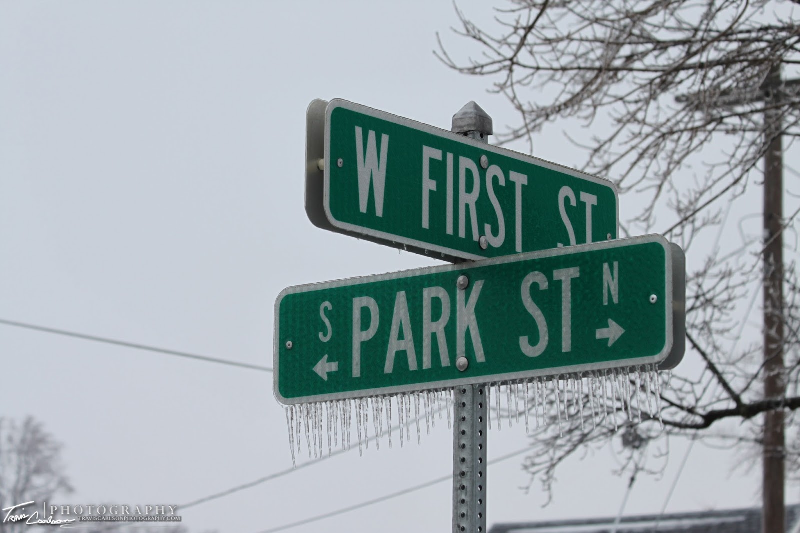
 What's incredible is how uniform the
ice can get on these street signs
 Wind vane coated in ice as well...
Most roads were in decent shape...however try driving down some
rural-roads after these events...
(You'll be probably cursing up a storm)
 Power line encased in ice... hence why many lose power folks...
 Even the lawn is somewhat picturesque as
well and not to mention a tad crunchy too
 Macro-lens shot...this lens works wonders in the winter season
 Home sweet home...only about 41% of Ameren customers
in this county were without power Thursday...
 Probably my favorite rural-area shot from this ice storm
 Power lines still coated with ice here in this small valley
 Along Rt. 78 looking south (this highway actually was a joke until this
past fall when the stimulus money arrived)
 Farm in the background with ice coated Willow trees in the foreground
 Black Hawk East College
 Street sign and an ice coated tree
 New hospital on the southwest-side of Kewanee, IL
 Ok, not the "going green" a storm chaser is thinking of...
 What do you know...power crews are on the scene
 Close-up...looks like their were some serious problems here...
 Main St. for some reason I'm thinking of the "disconnect between
Wall St. and Main St." or maybe that's just
my political nature talking...hmm
 This shot would have been 10x better with some sunshine
 I thought this shot was interesting with an ice coated tree
taking up the (foreground) with a street
name sign in the (background)
 Another stop light with the icy glaze...
(again would have been spectacular at night) grr...
 Willard St. outside Wethersfield High School
I've added a short YouTube clip illustrating
the thaw this past Friday (above)
Well that's all for now...besides the cold here in the Midwest the weather should be pretty dull over the next few days except if you're located in the Southern Plains and Deep South. That's where another ice storm could be found along with some severe thunderstorms as well. I'll be making a short stop to South Bend, IN in the coming days...so I'll probably update at some point with some photos when I get back...
I did I snapped this photo after the ice storm
(particularly trees oriented north-south)
don't open in these events routinely
ice can get on these street signs
Most roads were in decent shape...however try driving down some

rural-roads after these events...
(You'll be probably cursing up a storm)
well and not to mention a tad crunchy too
in this county were without power Thursday...
past fall when the stimulus money arrived)
This begins another section of ice storm photos from Kewanee, IL within city limits. Like I said I am still kicking myself for not getting some night photography photos..argh!
 From pure observation it appears Kewanee, IL had
more ice accumulation than I expected (.25")

Stoplights glazed over...more ice accumulation than I expected (.25")

Wall St. and Main St." or maybe that's just
my political nature talking...hmm
taking up the (foreground) with a street
name sign in the (background)
(again would have been spectacular at night) grr...
where I graduated what feels like forever ago (2004)
 You can find these photo-ops everywhere you seemed to look...
 Beach St. seems like a dumb name for a street in the Midwest
One more street name sign for the dayI've added a short YouTube clip illustrating
the thaw this past Friday (above)
Well that's all for now...besides the cold here in the Midwest the weather should be pretty dull over the next few days except if you're located in the Southern Plains and Deep South. That's where another ice storm could be found along with some severe thunderstorms as well. I'll be making a short stop to South Bend, IN in the coming days...so I'll probably update at some point with some photos when I get back...