

Well folks it has been a long time since I've blogged, but don't you worry I've had some great catches over the last few weeks with an extremely active pattern here in the Midwest. On Monday, (June 14th) which was one of my few days off I kept an eye on a sleeper warm front play close to home most of the day. An albeit weak warm front would lift north on this day as early morning convection cleared out by midday allowing for rapid destabilization to take place in SE Iowa and west-central Illinois ahead of a weak surface low southeast of Des Moines, IA. This would create a small window of opportunity for backing winds ahead of this surface low near the Mississippi River. This directional shear combined with favorable shear aloft (0-6km approaching 50kts) along with instability approaching 2,500J/kg helped to create an environment favorable for supercells if they were to form. Sure enough near 3:00pm the first "blips" show up near Muscatine, IA as I was watching from the comforts of my own home. This storm quickly goes supercellular within an hour. Of course, I headed out the door as fast as I could and as I neared Galva, IL I'm informed of the first tornado report near the Mississippi River. I blasted west on U.S. 34 and by 5:30pm I let the storm cross the river. I caught up near Aledo, IL heading south on U.S. 67 with the storm turning more southeast toward my location. On reflectivity this thing looked pathetic, but boy that turned out to be a good thing on this day as this storm was (LP) low-precipitation giving you spectacular structure all evening. It produced at least one funnel cloud while I was chasing this supercell, but low-level shear just wasn't quite strong enough for tornadogenesis later in the evening it seemed. Boy, did this supercell spin like a top though! It was a beautiful storm and its slow storm speed allowed you to really enjoy the show. It was an arm-chair chase with limited chase convergence. Not often do you get one of those days anymore in which you have a supercell pretty much all to yourself! I ran into a few chasers along my path one from Wisconsin and Brad Goddard from the Quad-Cites, but other than the few of us chasers present many missed this beautiful LP supercell. It didn't produced a tornado for myself, but oh well, it was a surprise chase that gave me a beautiful LP supercell so...I won't complain one bit! I've added my favorite photos from the day below:


West-bound on U.S. 34 heading toward the convection

Lowered-base and eventual wall cloud

This thing goes crazy for a few minutes here with intermittent
funnel clouds with chaotic rotation

funnel clouds with chaotic rotation

Look close you'll find a nice funnel cloud back in that base

Supercell continues southeast at maybe 25mph which allowed
for some time-lapse video for once this year

for some time-lapse video for once this year
I thought at this point I might get what I wanted with inflow
increasing and southeast winds at my back...she was a tease though ;)
 Very nice!

increasing and southeast winds at my back...she was a tease though ;)
Storm just continues rotating all evening
thanks to the nearby warm front

thanks to the nearby warm front

Since it appeared it wasn't going to produce a tornado
I dropped south to get a taste of the structure
south of Alexis, IL on IL-1 here

I dropped south to get a taste of the structure
south of Alexis, IL on IL-1 here
Starting to get that "flying-saucer" look...

The beginning of some beautiful west-central
Illinois supercell structure...

Illinois supercell structure...
Amazing mid-level rotation here... I was happy
I had time-lapse video going as well at this time

I had time-lapse video going as well at this time
You don't see photos like this coming from Illinois too often since
most of the supercells end up being quite
"grungy" in this area

most of the supercells end up being quite
"grungy" in this area
Area-of-interest a mile up the road!

What a beautiful supercell!

Circulation rotating still as it passes to the east
(looking east at its backside)

(looking east at its backside)
After getting cored by a weak RFD I'm
rewarded with this rainbow

rewarded with this rainbow

One last shot of a once beautiful supercell dissipating
underneath an alto-cumulus deck
underneath an alto-cumulus deck
Here are some photos from Tuesday evening (June 15th) as some pulse convection formed at peak heating near sunset allowing for some more picturesque photography below:


Updraft in the western-horizon

Remnant convergent/outflow boundary near sunset

Bubbling convection punching through some cirrus
(Canon telephoto-zoom lens) yet again...

(Canon telephoto-zoom lens) yet again...

Similar shot as above just some different colors
with the changing sun-angle

with the changing sun-angle
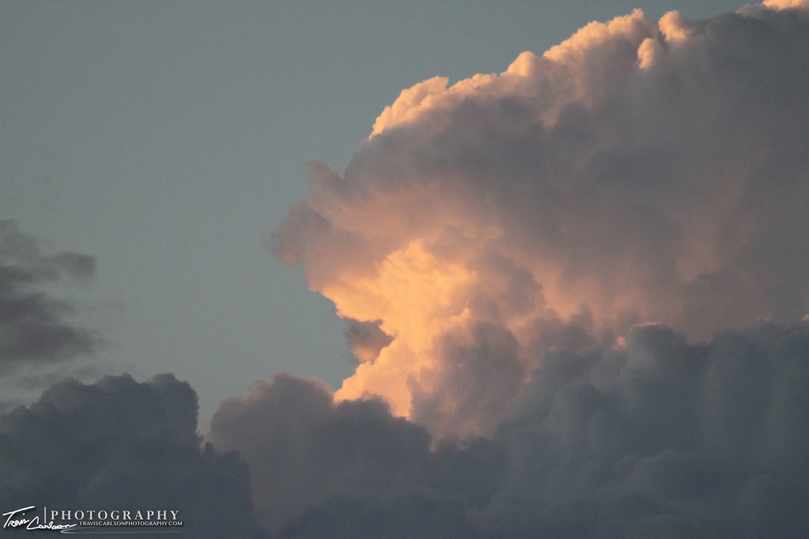
Beautiful sunset with the atmosphere trying to spark convection
One of the better anvil shots I've gotten this year
(Canon telephoto-zoom lens)
 Beautiful colors!
 More convection...
Portrait-view of this updraft at sunset
 Colorful!
(Canon telephoto-zoom lens)
Portrait-view of this updraft at sunset


I've added a YouTube time-lapse of the LP supercell (above)
That's all for this chase day at least. A rewarding chase with limited chase convergence and only required one tank of fuel since I was so close to home. Got to love those chase days! Stay tuned...I've chased many more days over the last couple weeks and will eventually update those chase logs as well.