

near Pocahontas, IA
Thursday, (June 17th) was an indeed frustrating day. The night before the event I targeted the Spencer-Sheldon-Storm Lake, IA triangle. As I made my way to northwest Iowa on this chase day everything seemed to be coming together for some nasty severe weather including a possible strong tornado, but Mother Nature left me in the dust it would turn out. The target-area featured 4,000J/kg of CAPE, plenty of shear, a very moist boundary layer with dew points around 70°F, and a sharp cold front serving as the lifting mechanism. The cap held most of the day as the atmosphere quickly destabilized after morning convection. Unfortunately, storms developed farther northeast than even I expected and therefore veered the surface winds over the target-area. In other words, that killed the directional shear needed to sustain rotating updrafts over the target-area as initiation began near my location. I do recall the 4.0km WRF (God model) however showed a similar trend in its 12z run that day and apparently I should have paid more attention to it perhaps. Turned out the main show with tornadic supercells developed initially as crappy storms to my northeast that I didn't bother with which turned out to be the wrong decision on my part. Seeing tornado after tornado report come in to my northeast though was quite a sad feeling especially when one was a wedge...grr. Anyhow, after screwing that up I ended up chasing some storms near Storm Lake, IA along the cold front, but because of the veered surface winds these storms struggled to become supercellular. Another problem that contributed to the lack of tornadoes was how each storm would "seed" another to its southwest flank which would cut off the updraft once when it would begin to lower its base. Ya, not a great day for myself chase-wise. I made the best of it though chasing a squall line with embedded supercells along the drive home along the Highway 20 corridor in north-central Iowa. I was treated with some spectacular mammatus clouds at sunset though...which made driving home tornado-less a tad more easier. I've included photos from the chase day below:


An attempt to form a wall cloud

Supercells producing tornado after tornado to the northeast
while I get their anvil shadow...argh!

while I get their anvil shadow...argh!
Anvil shadow-effect killing vertical growth here
not allowing the atmosphere to "bake"

not allowing the atmosphere to "bake"
Finally, a wall cloud but well too late in the evening


Wall cloud bout to get undercut...frustrating!

Wide-angle shot of convection struggling
to maintain supercell characteristics

to maintain supercell characteristics

Embedded supercell (lowered base (right))

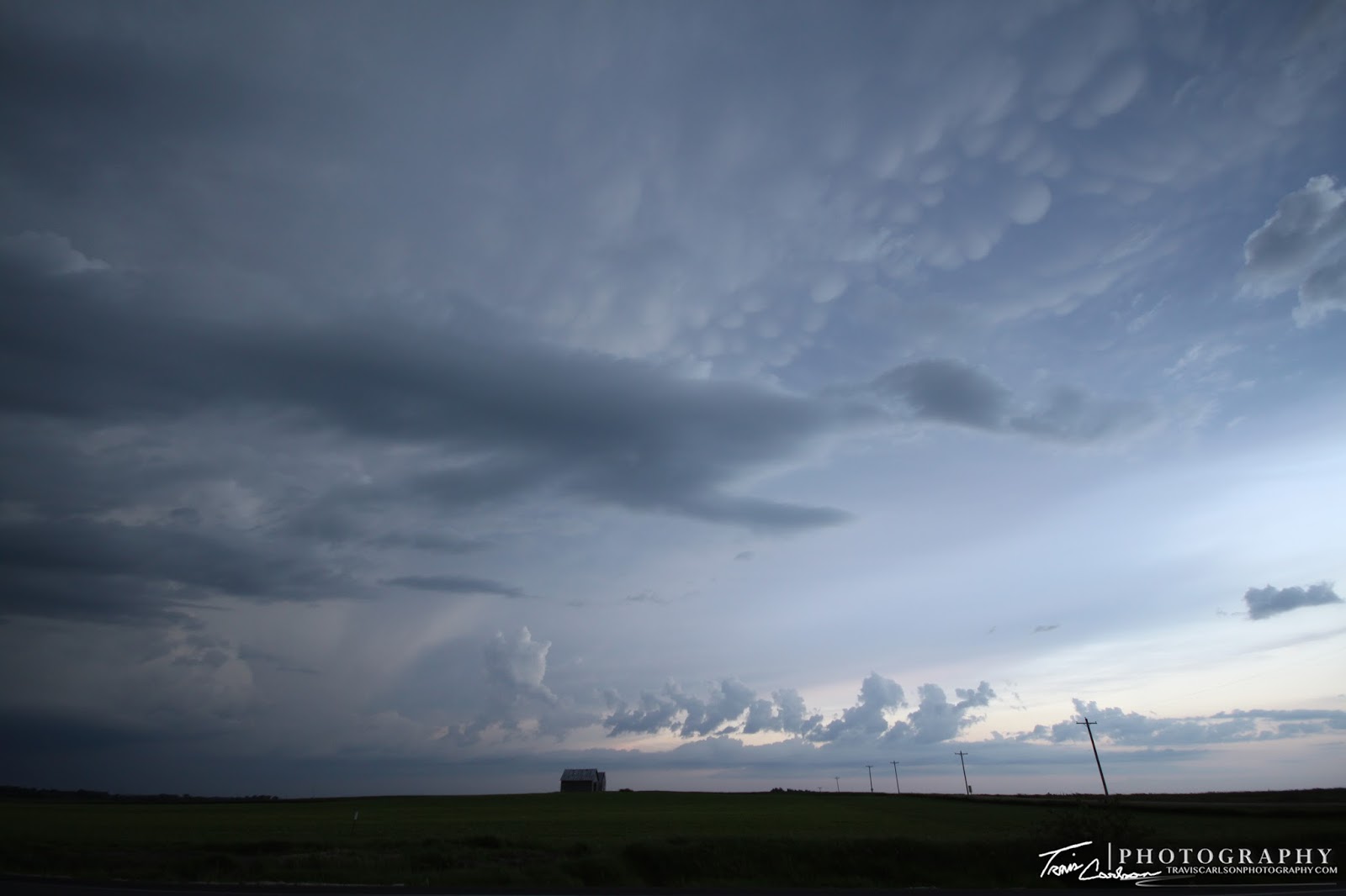
Lots of mammatus clouds on this chase evening

Squall line that would show some areas of brief rotation
at times, but nothing spectacular

at times, but nothing spectacular
A mammatus and anvil-filled chase

East of Pocahontas, IA at this point
Stunning mammatus at sunset here

Squall line continues east as the sun begins to set
 Close-up of the amazing mammatus clouds on this evening

My mobile weather station providing a nice photo-op
More and more mammatus shots
It was a tough chase, but they all can't go smoothly. I'll update with another post as soon as I get some free time as Mother Nature has kept me way too busy as of late...