

A surprise supercell develops on this evening along the Illinois River near Lacon, IL
On June 10th, I ventured out for a backyard chase during the evening after getting off work in Peoria, IL. A cold front was moving southeast across central Illinois on this day and extreme instability was building along the boundary by evening. I was hoping I'd catch a severe thunderstorm or two on this chase day, but not expecting much due to fairly marginal shear along the cold front. With that being said, I headed northwest along IL Rt. 91 with a target of Toulon, IL where moisture convergence along the cold front would erode the cap. This area featured extreme instability with 5,000J/kg of CAPE, 0-6km shear at 25kts, and a very moist boundary-layer with dew points near 70°F. By evening, I watched convective initiation take place nearly overhead as the cap eroded allowing severe thunderstorms to quickly explode seen here. I spent most of the evening tracking a few severe thunderstorms that formed in rural Stark County, IL. By 5:30pm, I noticed the cell to my northeast seemed to be getting more organized visually so I preceded to head east near Lawn Ridge, IL snapping some photos of this intensifying severe thunderstorm. Soon thereafter, this storm goes tornado-warned and begins to spin. This supercell had a nice velocity couplet for a time, but struggled to maintain its outflow unfortunately. A tornado-warned storm on this day was definitely not expected with marginal shear present, but this storm's deviant storm motion could very well be the reason it became a supercell. Anyhow, it would continue to back-build west toward my location so I was able to grab a few pics as I caught up to the back-side of the hook of this supercell on IL Rt. 17 west of Lacon, IL. It had a nice wall cloud, but struggled to maintain itself as it was largely outflow dominate throughout most of its life-cycle. As sunset approached I began to venture back to Peoria, IL while dodging some torrential rainfall from these thunderstorms. I've added photos of the storms from this particular evening below:

Convective initiation begins along the cold front in Wyoming, IL
 A high-based thunderstorm develops to my northeast!

A whole lot of precip loading going on here...

A rainbow forms in the eastern horizon!

Convection continuing to blossom along IL Rt. 28!

Quite a vivid rainbow display from Mother Nature!

A rain foot with this storm's intense downdraft...

This storm is about to become a supercell as it begins to strengthen...

This severe thunderstorm is continuing to organize...

A wider shot of a stormy horizon!

Another brief rainbow as the sun back-lit the storm!

I move northeast as this storm begins to gain some rotation!

Closer-view of a lowering base and wall cloud...

Supercell having trouble containing its outflow at this point!

Rainbow #3 forms along this stormy rural-landscape!

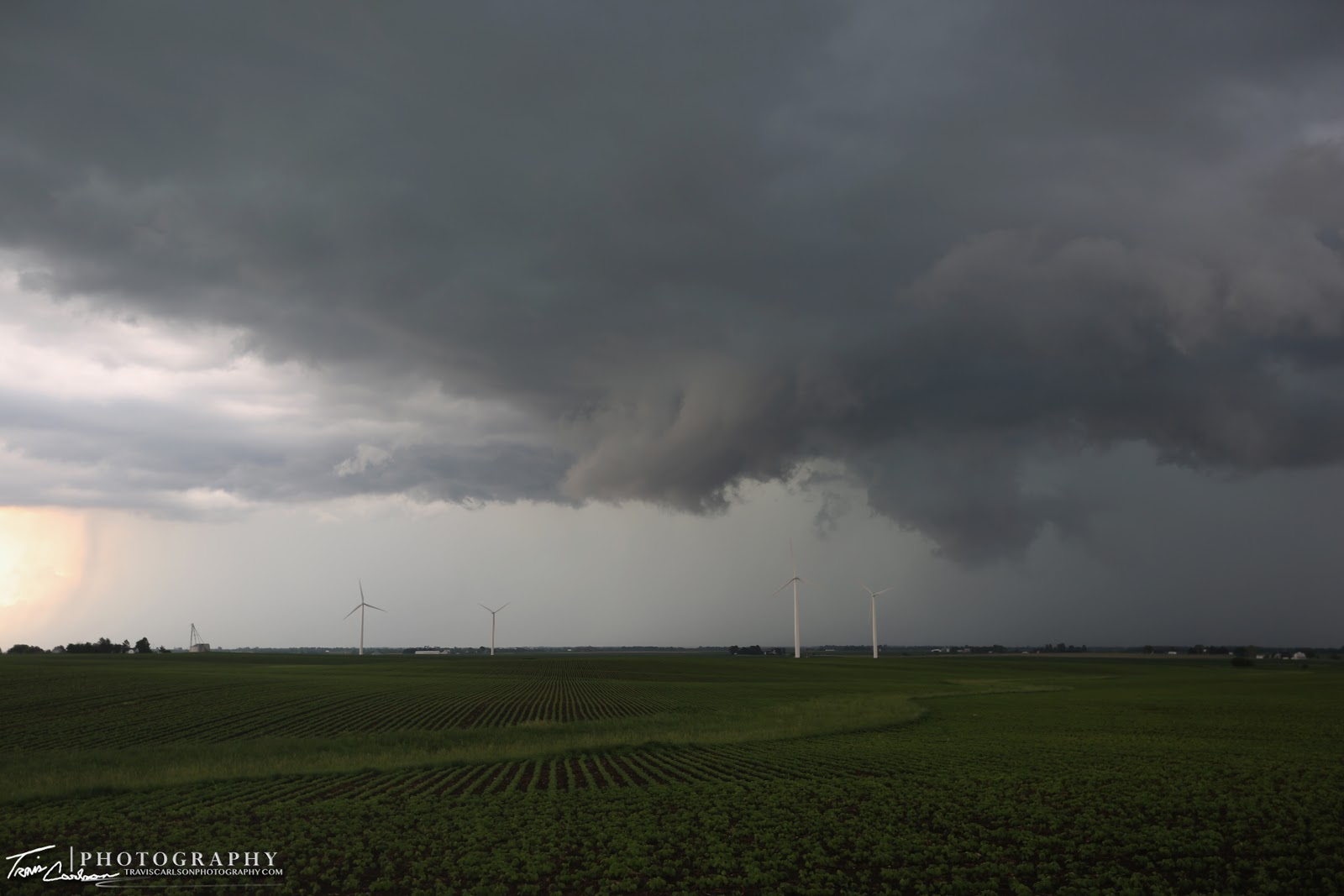
The supercell continues to back-build westward allowing me to get another view at a wind farm west of Lacon, IL along IL Rt. 17

This was a messy storm as it struggled with the lack of wind shear on this evening...
Outflow dominate supercell nearly stationary at this point!
That's all for this particular chase day. It was sure nice to get out once again and view some storms locally. It was also nice to view a surprise supercell on this evening as well. I would later storm chase some more over the coming days and weeks and I'll be posting those accounts in the coming days and weeks.