

A supercell forms during the mid-afternoon north of Lynn Center, IL

On June 15th, I once again decided to storm chase locally targeting a cold front that was moving southeast into west-central Illinois. I spent most of the morning on my day-off photographing some thunderstorms that were developing along a pre-frontal confluence zone in Peoria, IL. After spending a hour or two shooting these non-severe thunderstorms I decided by early afternoon to head northwest on I-74 targeting Orion, IL along the cold front. This area featured 2,000J/kg of CAPE, 0-6km shear at 35kts, and a very moist boundary-layer with dew points near 73°F. By 3:00pm, I was sitting near Lynn Center, IL along I-74 watching convection blossom and intensifying along the cold front. I had a great view as these storms continued to develop feeding off the surface-based parcels to the south. I continued to keep up with the tail-end cell along the boundary moving northeast near Osco, IL where this thunderstorm became a supercell as it began to rotate. I continued northeast along IL Rt. 14 tracking this supercell through its life-cycle. Around 3:30pm, this supercell was at its strongest with a well-defined rotating wall cloud which produced a couple cone funnels along IL Rt. 14. This storm was teasing me most of the afternoon! Once the supercell became outflow dominate due to more storms seeding along the cold front to its southwest flank I decided to venture south on IL Rt. 78. I continued to drive south stopping along a rural country road just south of Kewanee, IL. I spent a good half-hour here snapping photos of the increasingly outflow dominate convection pushing south toward my location. It got "dark" pretty quick in the northern horizon with so much water vapor in the air and the sun shining as well. I continued south keeping up with these photogenic storms stopping several times along IL Rt. 78 in rural-Stark County, IL. This is where I grabbed a really awesome photo of one of the coolest shelf clouds I've witnessed with the sun illuminating the shelf cloud and a clear view of a convective updraft surging upward along the shelf cloud. It was one of the coolest photos I shot on a very productive day of photography. I spent the rest of the evening continuing to head southeast in rural-Stark County, IL snapping several photos along the way. By late evening, I was back in Peoria, IL near sunset as the shelf cloud and convection moved into Peoria, IL. I photographed the shelf cloud yet again at this point. Once when the shelf cloud overtook my location I headed indoors for the remainder of the evening. I've added a large amount of photos from this chase day below as it was quite a photogenic display Mother Nature provided on this chase day:
Convection during the mid-morning hours along a pre-frontal confluence zone in Peoria, IL

This storm got close to being surface-based and becoming severe...

An image that you would think came from Florida instead of Illinois...

"Chasing water vapor"

I thought this was a cool landscape photo while I was waiting for storms to initiate!

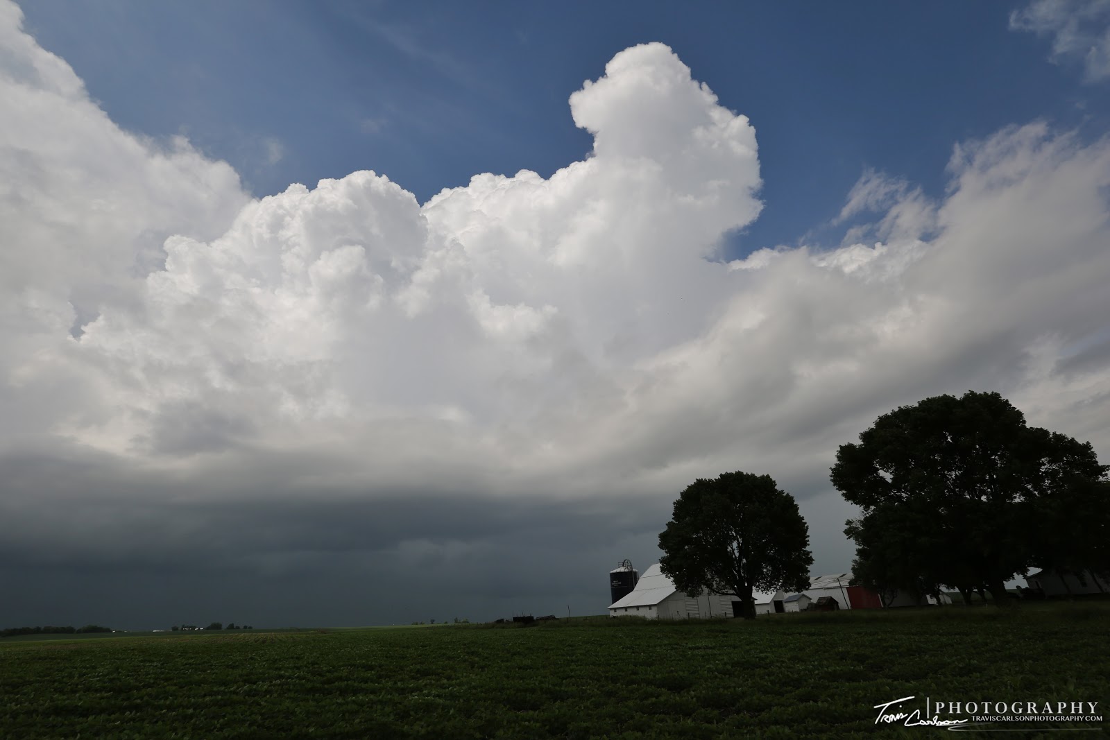
Another neat landscape with an abundance of cumulus clouds in the sky!

"Clouds building"
Quite a photogenic shot at this farmstead along I-74!

Hay bales can make for a great addition to landscape shots seen here!

The sun was my friend on this day as it "lit-up" the foreground to my liking nearly all afternoon...

Quite a nice storm structure looking northeast!

This storm is continuing to intensify north of Lynn Center, IL

"Framing up the storm"

"Upward vertical motion"

I shot this same shot using my Canon 5D Mark III and Canon Rebel T5i and still can't decide which one I like the best, but it's a fairly neat comparison though!

"Warm moist air rising"

"A stormy landscape"

A powerful updraft accelerating upward!

The atmosphere was buoyant...I'd say!

Who couldn't find this view engaging?

Such a cool perspective!

A great shot!

This storm is starting to move away so I pack up the cameras and head northeast...

I continue northeast near Osco, IL where the storm begins to show signs of rotation...

"Nothing runs like a deere"

Wall cloud quickly begins to wrap up along IL Rt. 14!

Funnel forming...

Damn, she's so close...

This supercell seemed to be contemplating...should I tornado or not?

This cone funnel teases me for a time and nearly touches down again!

Farther east the storm starts to become outflow dominate though...

Another neat view!

Messy outflow at this point...

An amazing landscape south of Kewanee, IL

"Wide open spaces"

Watching tall grass prairie move with the wind toward a storm never gets old!

Another powerful updraft accelerates vertically along the boundary!

A storm landscape like this I would expect to shoot in the Great Plains rather than Illinois...

A photogenic shelf cloud traversing the Illinois prairies!

Convection starting to get a little too close for comfort!

"Highway to a storm"

An epic shot of one of the coolest shelf clouds I've ever witnessed!

A new updraft forms along the shelf cloud!

One of the blackest skies you'll see around 5:00pm!

A great storm to photograph!

"It's amazing out there"

A wide-angle shot of the convection moving southeast!

"Dark skies loom over this farmstead"

Would you think twice about heading north along this highway?

Flooding June rains still evident in this farm field with more torrential rainfall on the horizon!

This storm is continuing southeast now along the Spoon River in rural-Stark County, IL

I arrive back in Peoria, IL to photograph the shelf cloud once again...

This red barn and farmstead I've shot quite a few times over the years...

Shelf cloud is about to overtake me at this point...
This was quite a rewarding chase day for myself because it definitely provided me with some of my best storm photos of the year up to this point. Mother Nature sure put on a show on this day with photogenic storms! I would also storm chase on June 22th and I'll update with that post over the next few days as well.